
Wednesday, May 25, 2022
- Getting Started
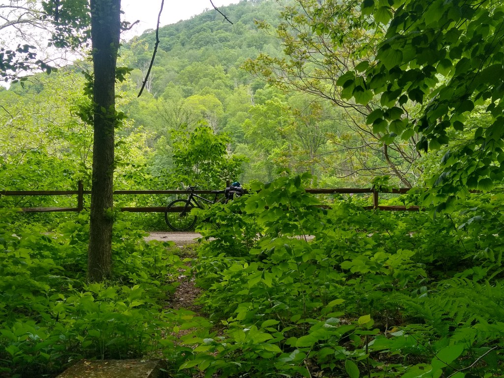
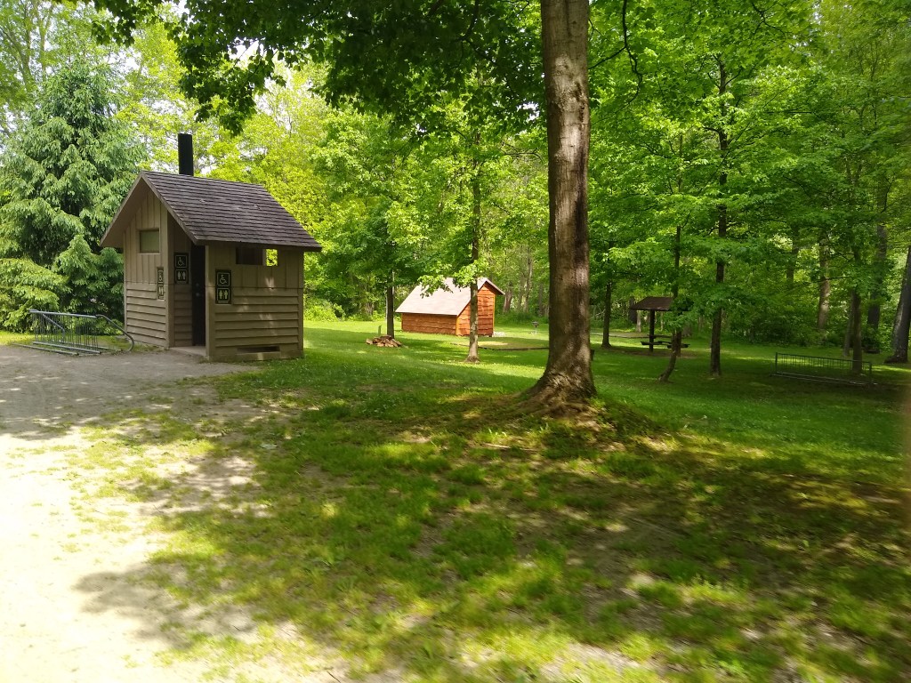
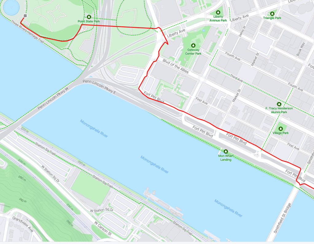
- Cumberland G.A.P. Mile 0
- 23 Miles of False Flat
- Frostburg Mile 15
- Mason-Dixon, Big Savage Tunnel, and the Continental Divide
- Keystone and Salisbury Viaduct, Meyersdale
- Mile 43.5: Reaching Rockwood, PA
- Sarting Day 2
- Ohiopyle State Park and the Town of Ohiopyle
- Connellsville, PA
- Starting Day 3
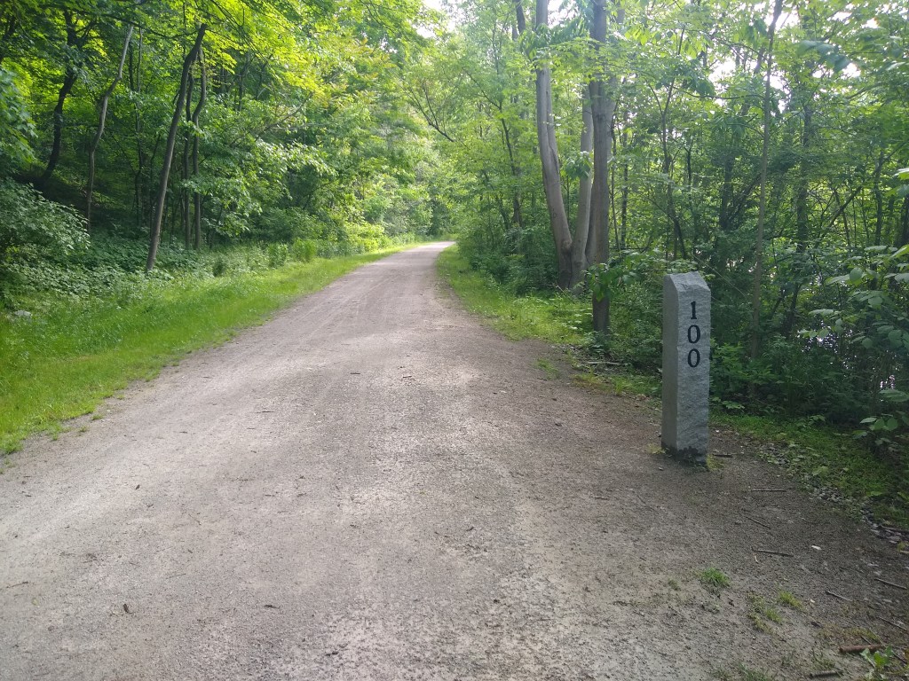
- Mile 100!
- West Newton, The Red Waterfall, and Dravo Campground
- Boston, the last small-town-feeling
- F*%king McKeesport
- The Pumphouse and Homestead
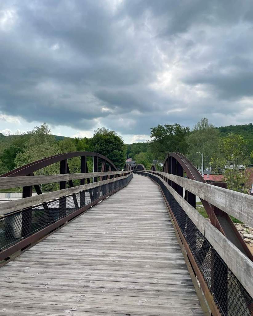
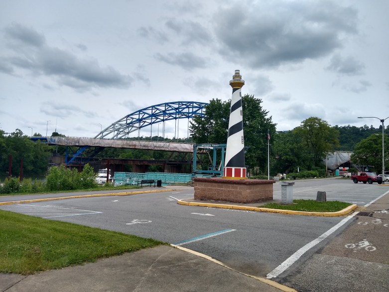
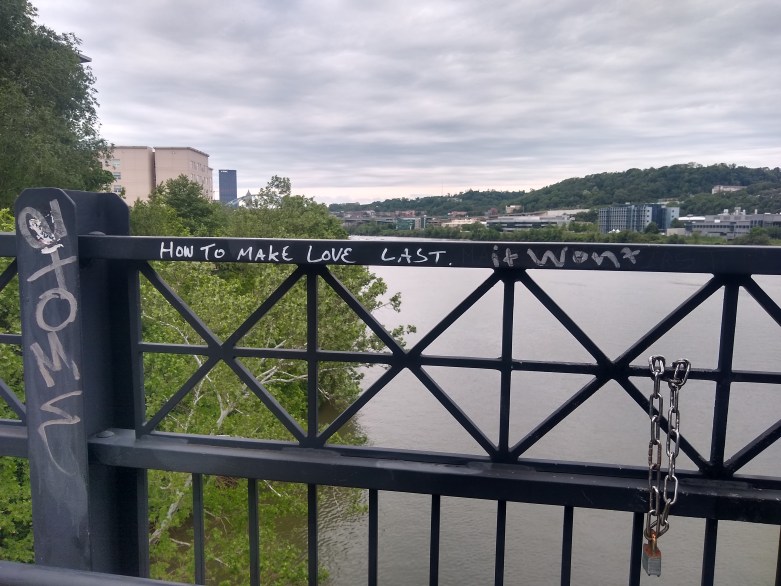
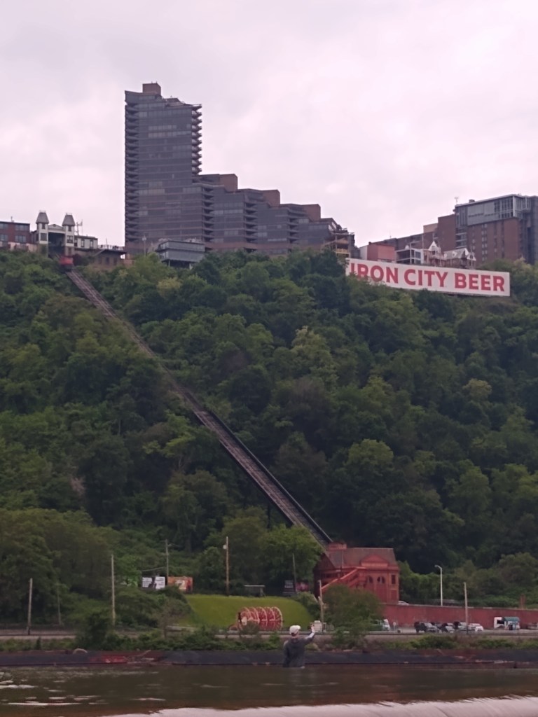
- Mile 150! Point State Park
- Amtrak Back
- In Conclusion
Getting Started
On May 20th, 2022 my sister Jenn and I started out on a journey down the Great Allegheny Passage. I had completed the trail once before in 2015, and had been planning a return trip since January of this year.
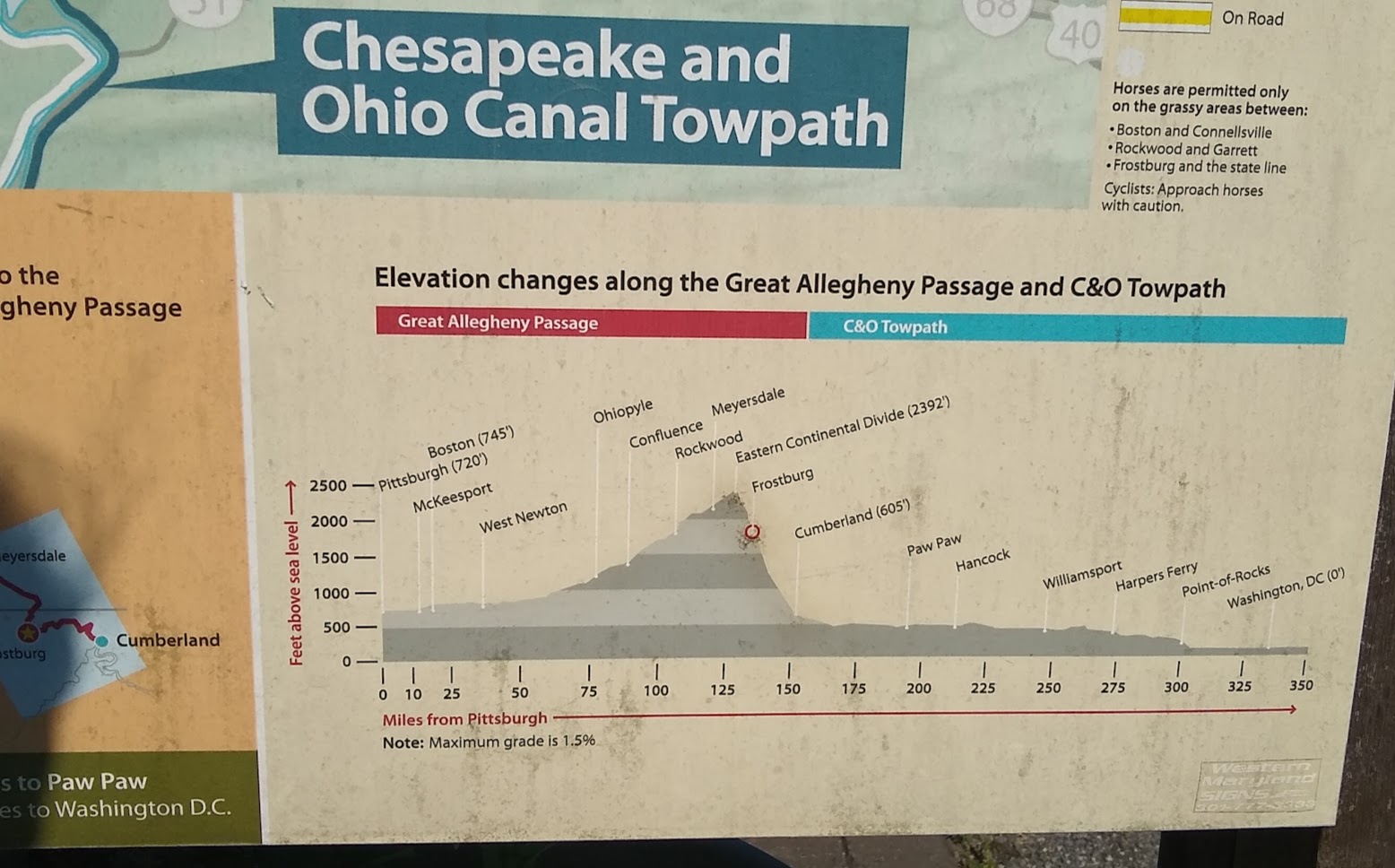
The GAP covers 150 miles from Cumberland, MD to Pittsburgh, PA. The first time I completed it I gave myself 5 days and ended up completing a day early. I planned a total of 3 riding days this time (and my actual daily mileage would differ from this plan due to weather technicalities):
- Day 1 45 Miles
- Day 2: 60 miles and
- Day 3: 45 miles
Truthfully, my inner badass wanted to do the entire thing in a much shorter span. But inner badass or not, this trail has so many scenic opportunities that you’d completely blow by at that speed, and I wanted to take my mind on a journey as much as my body.
In February, I found out I was pregnant, and after processing that family-size-changing news the first words out of my mouth were “I hope you know I’m still doing the GAP”. (No one argued with me. Probably because they figured as much.)
Jenn planned to ride with me the first 2 days, staying overnight with me in Rockwood, PA and shuttling back from Ohiopyle at Mile 72 so she could work on Monday. The remaining days I’d be alone, and I couldn’t recommend that more. Women, seemingly more so than men, are scared of this type of endeavor. I’d encourage anyone entertaining the idea to be smart but do it. Don’t think about it too much. Focus on preparation rather than fear.
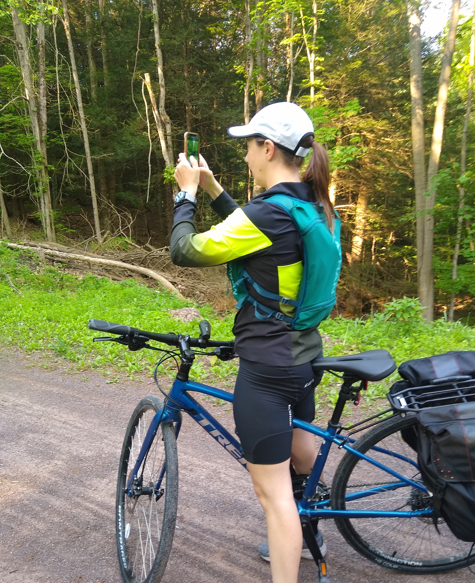
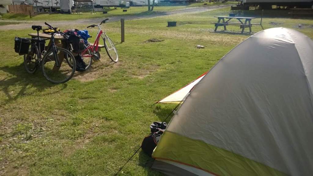
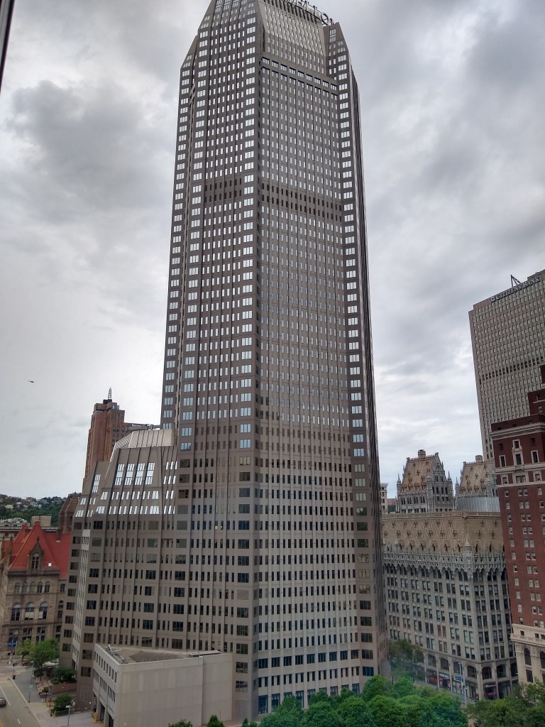
Saturday, May 21st, was going to be a scorcher I didn’t expect for May. 95 Degrees as a high, plus humidity. For this reason, we stayed the night at the Ramada in Cumberland to get a head start the next day. Cumberland is a beautiful place with a really unique skyline. The old has somehow merged with the new in a way that seemingly every building has a story to tell, and the steeples shooting up into the skyline at sunset take their own place in the sky so beautifully.
When I said hesitantly, “We should probably get up around 5 or 5:30 to beat the heat, she said “Alright, sounds good”.
My sister, not being a little bitch.
One thing I often forget about my sister, we are cut from the same cloth when it comes to adventure (a trait that neither of our parents have, so it’s a bit perplexing). When I said hesitantly, “We should probably get up around 5 or 5:30 to beat the heat, she said “Alright, sounds good”. Alright sounds good? Okay! There I was, expecting to have to rationalize the reason for my decision. Turns out the being a little bitch skipped our generation. The number of times I have to dial myself back about 30% on group activities, which I don’t mind whatsoever if it means others get to enjoy it, is innumerable. So, 5:00 it was.
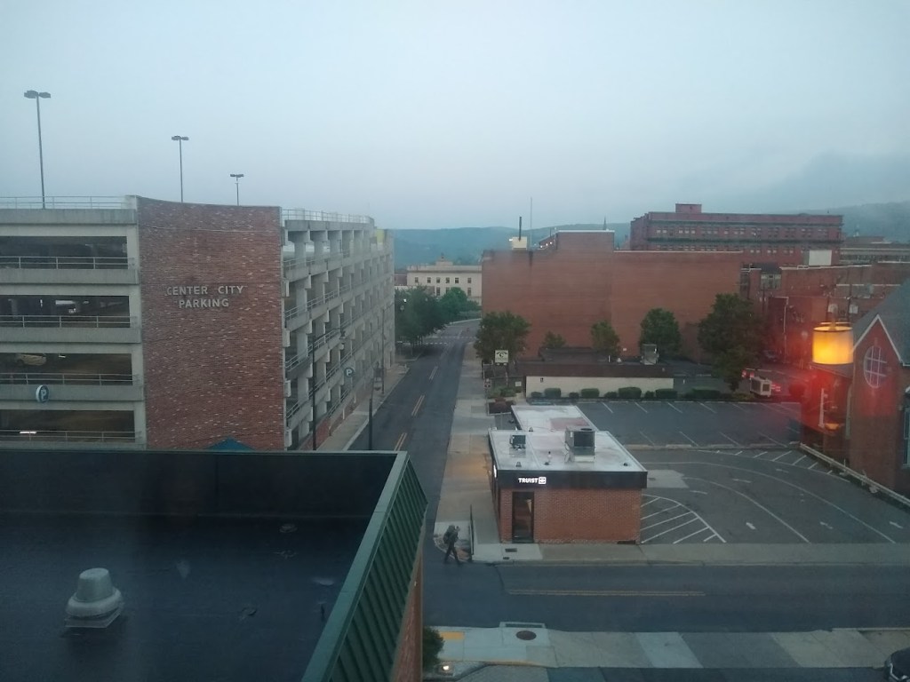
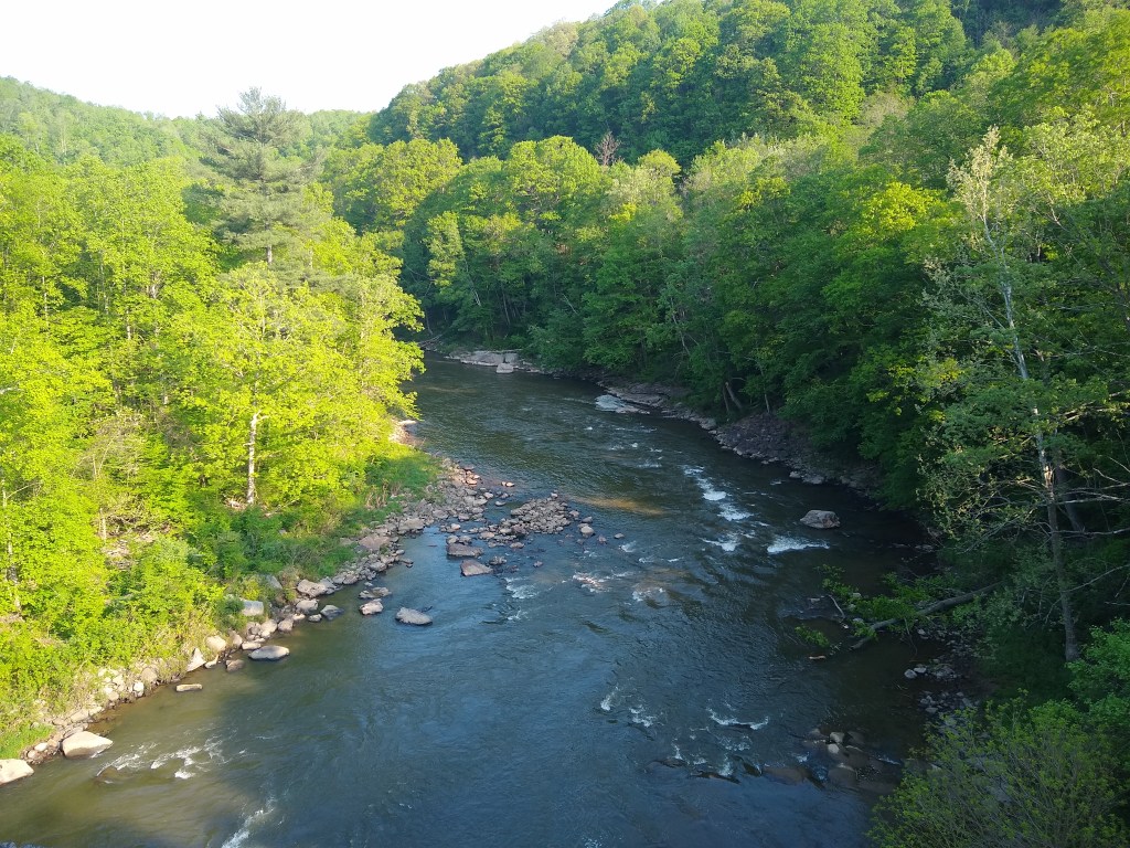
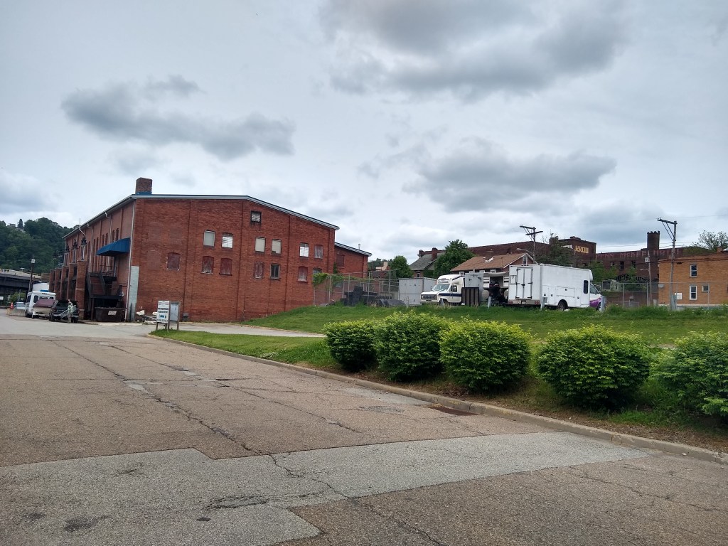
Cumberland G.A.P. Mile 0
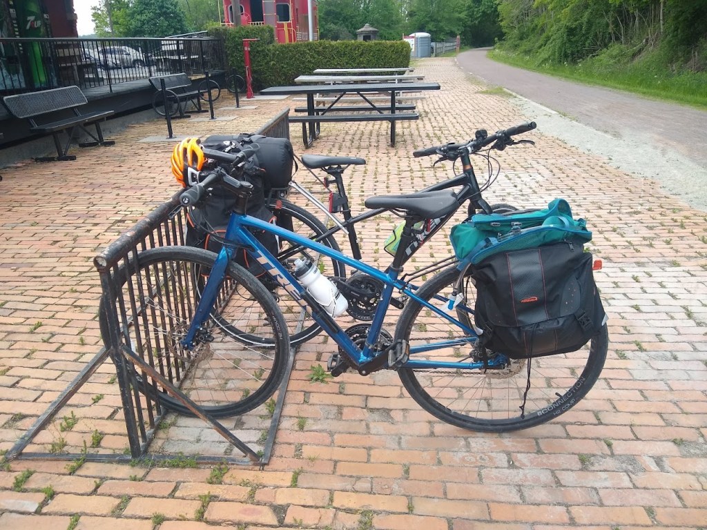
Starting out that morning we parked in the garage across the street (they do offer weeklong parking at a very reasonable rate) and we coasted toward the trailhead which is beside/ at the Western Maryland Scenic Railroad office. This is also the north end of the C&O Canal Towpath Trail, which I completed in 2014. Jenn and I had recently completed a segment of the C&O so it was cool getting to see this end of it again. Just like the Great Allegheny Passage, the C&O is full of historic landmarks and sites.
Picking up the GAP trail from there, we were on our way. The mist had settled into the valley and while you could feel the heaviness of the impending humidity (it was already 72 degrees at 6am) it was simply a gorgeous sight.

Around mile 6 there is something called the “Bone Cave”. In the early 1900’s they excavated and found some prehistoric skeletons that were able to be reconstructed. They are on display at the Smithsonian in Washington DC, close to where I live now.
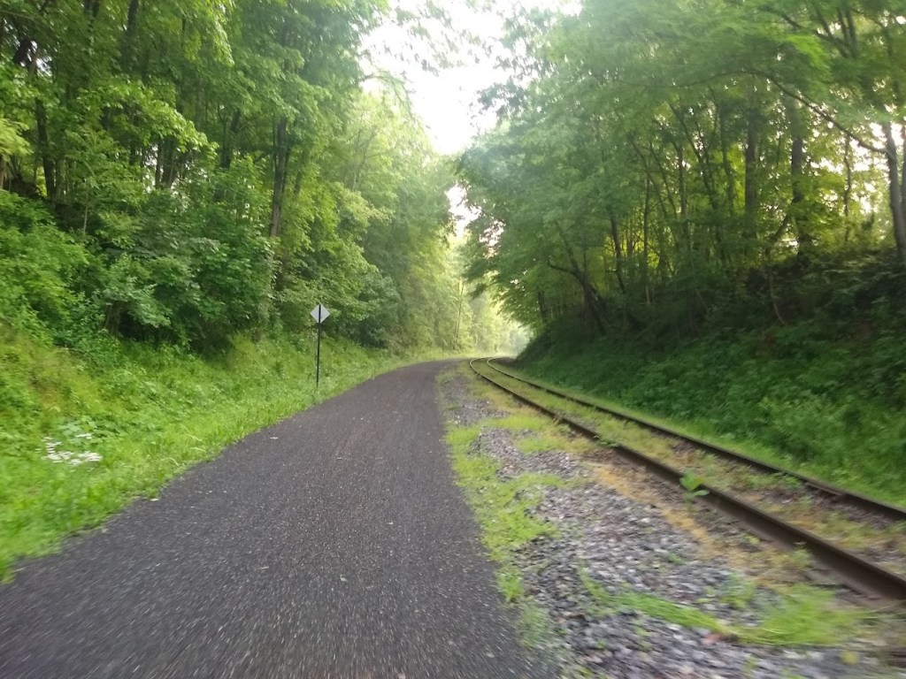
For the first 5 miles or so (maybe more) you’re switching across the track a lot. This is fine, but make sure to cross at a somewhat 90ish degree angle, especially if you’re carrying weight on the bike. For the first 15 miles most of the trail is beside active tracks.
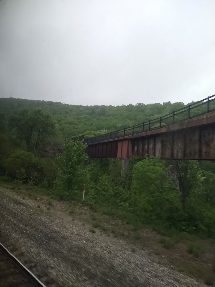
Somehow or another, even having been by this particular part 3 times, I have no photos of the Helmstetters (horseshoe) curve. The map above shows the location. If you’re trying to catch a train in the hairpin switchback, fellow riders told me the Western Maryland Scenic Railway should have information on times of day you could see this happen. Immediately after this landmark, you’ll go through Brush Tunnel (a short tunnel that still carries active trains, a few hundred feet long).

23 Miles of False Flat
By the time you’ve dedicated to riding the GAP you’ve probably looked at an elevation profile, but it’s hard to reconcile while riding because the surrounding area looks, well, incredibly flat. Believe it or not, Cumberland to the Continental Divide is uphill. This pisses you off watching everyone heading south fly by on what looks like flat, even terrain, when you’re drenched in sweat and smoldering in the heat heading north. You look around for any reasonable confirmation of why they’re flying by, coasting, and it further drains you mentally. But really, I promise, it is uphill.
Due to replacing any form of acceptable breakfast with pure enthusiasm, we started feeling drained pretty early and stopped for breakfast. Jenn felt it first (somehow, I felt fine on my standard pregnancy sleep unit of 4 hours) but by the time she got her energy back I started crashing. By the time we were in Frostburg, we were ready to take a bit of a break.
Frostburg Mile 15
Here we got confirmation of the elevation profile I had remembered, and it probably made us feel better about our slack asses than it should have. When taking a break here, there’s a bathroom and a bottle filling fountain. If you want to take the climb into town, you can. There’s a convenience store and a few other establishments (including another office for the Western Maryland Scenic Railroad).
The switchbacks into town have a lot of nifty artwork to enjoy on the way up. You can also take the road like my dumbass did in 2015, but I highly recommend the switchbacks.
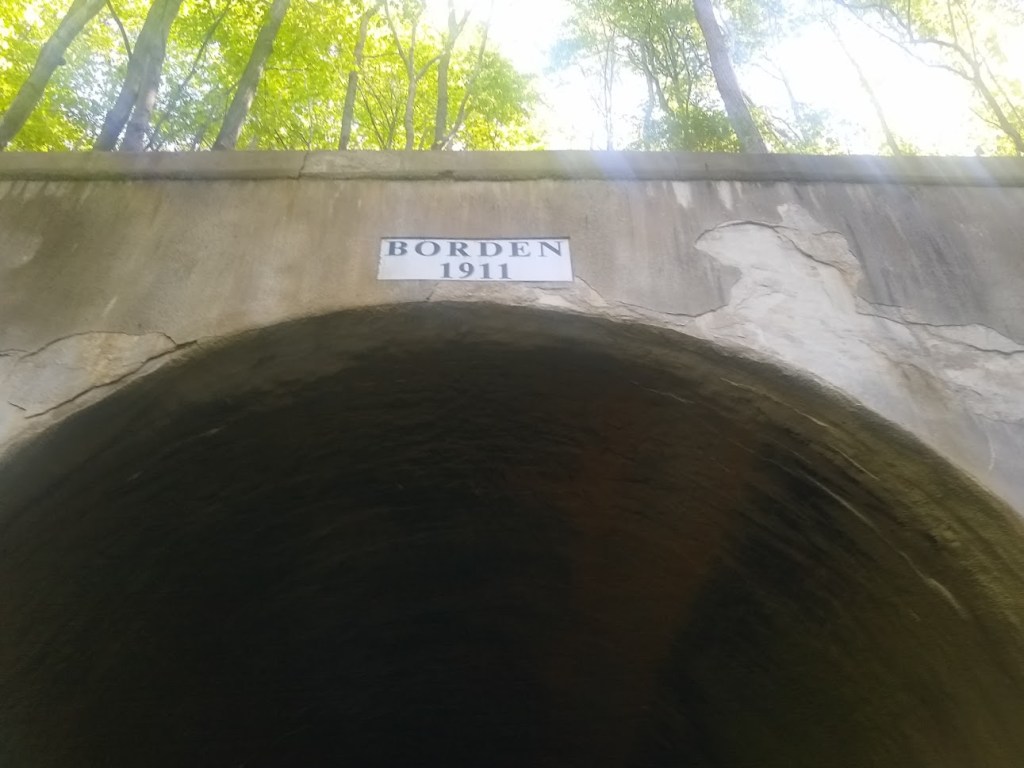
From Frostburg the next notable attraction is Borden Tunnel (around mile 17). This is a nice cool down from the hot day, so we stopped to snack again realizing there was no way we were beating this heat. My heart rate was in the 170s, probably due to the excess blood volume and I just felt as if the carbs consumed in Frostburg hadn’t hit yet.
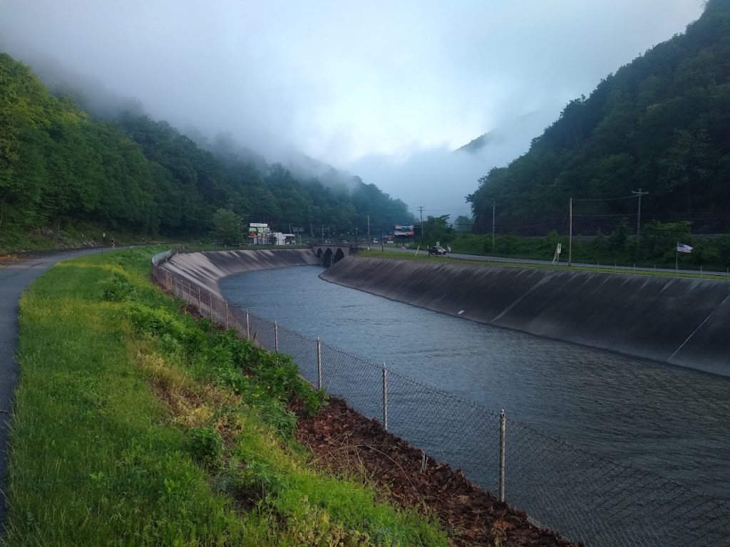
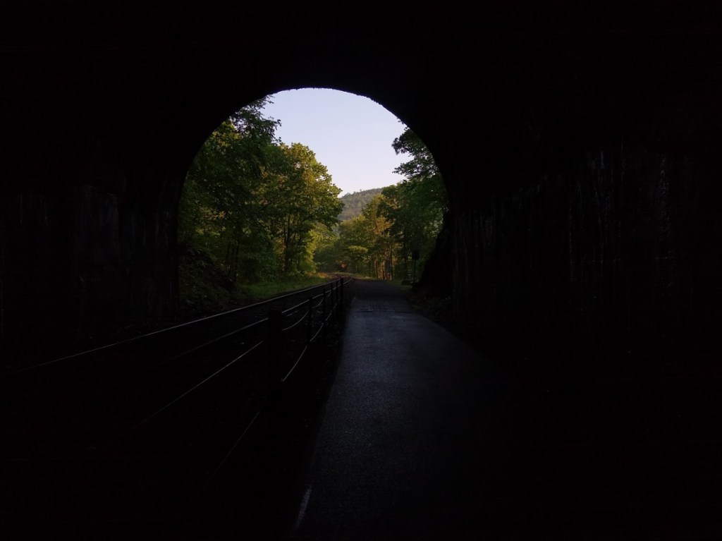
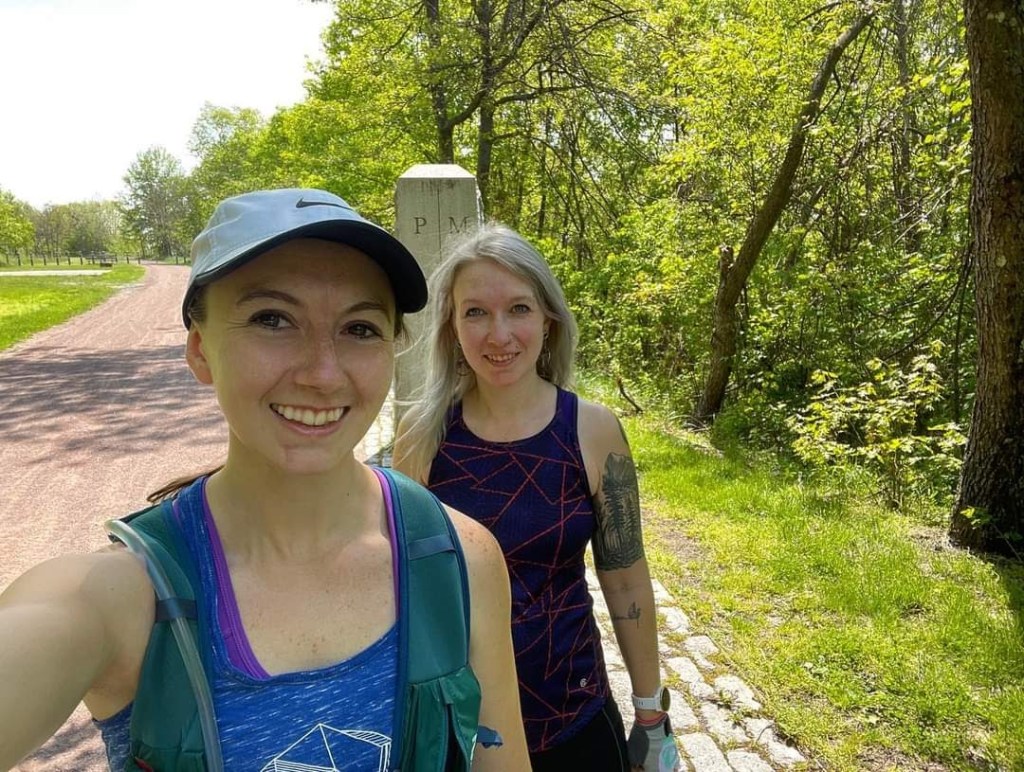
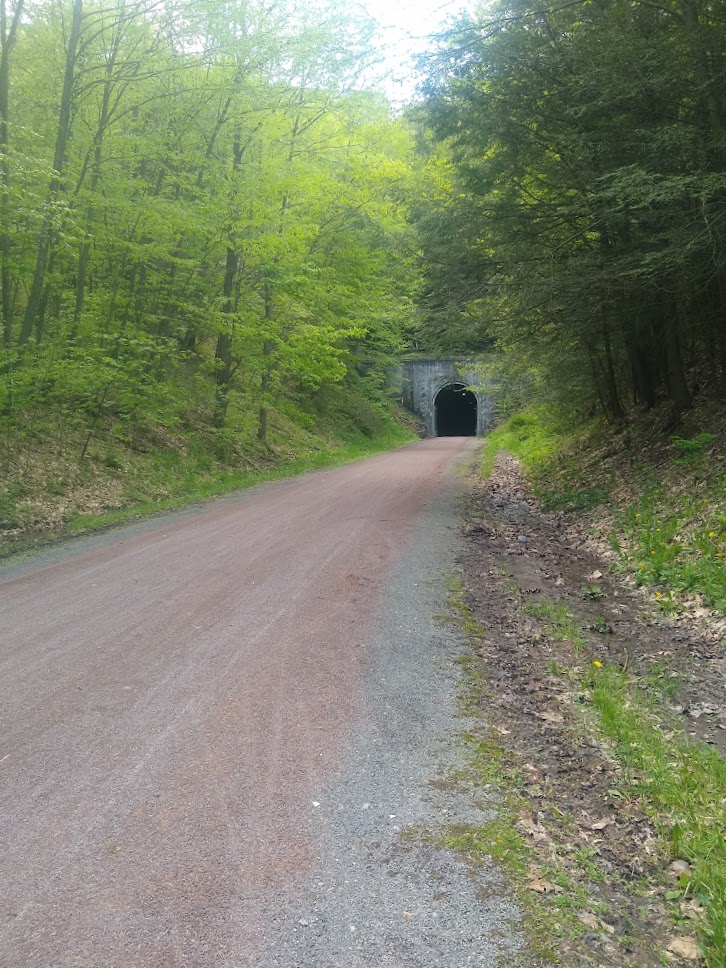
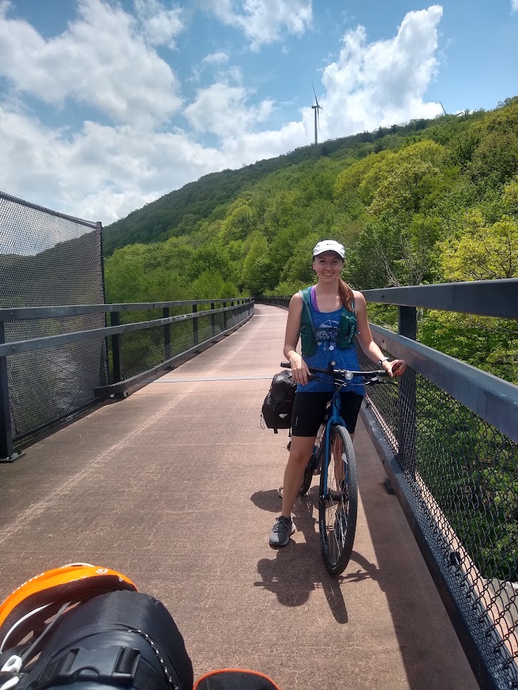
Mason-Dixon, Big Savage Tunnel, and the Continental Divide
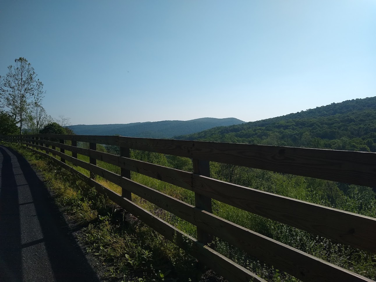
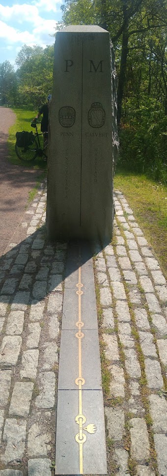
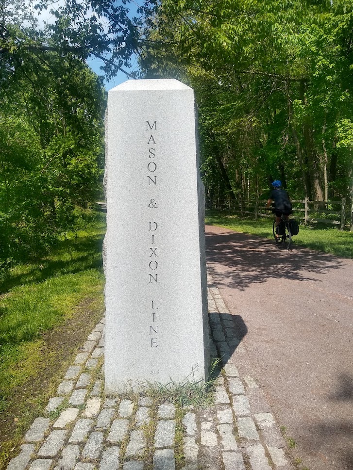
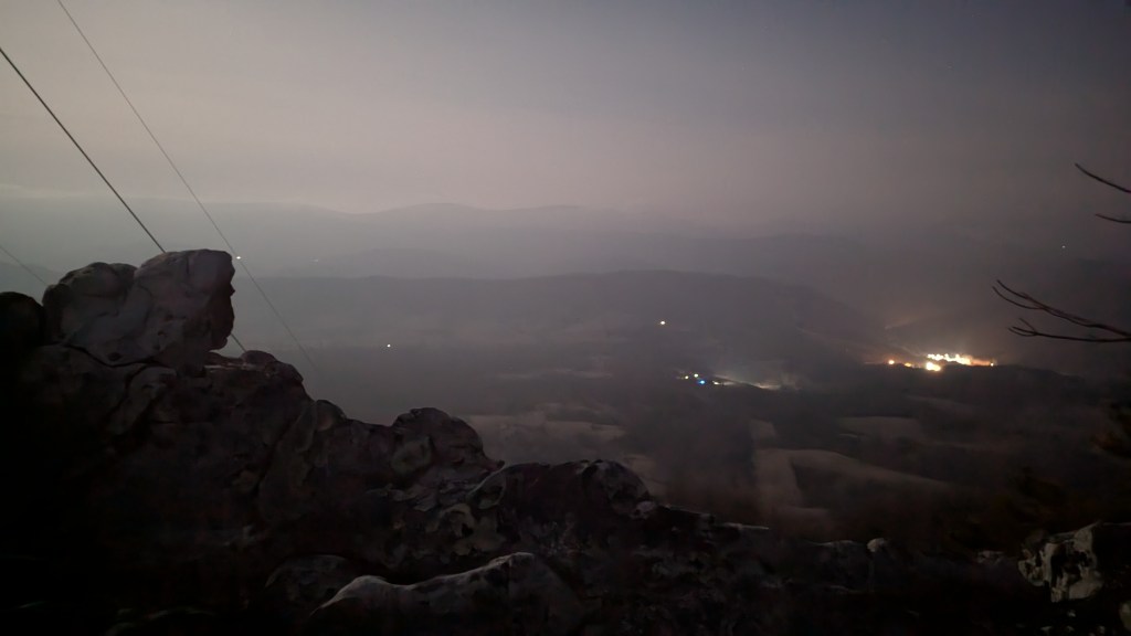
From my memory of my previous trip – the Mason-Dixon line (Mile 23) was a “must-stop”. Some very carefully and beautifully placed monuments and plaques give a full background on the area, and the breeze lets you know you’re nearing the top of the mountain.

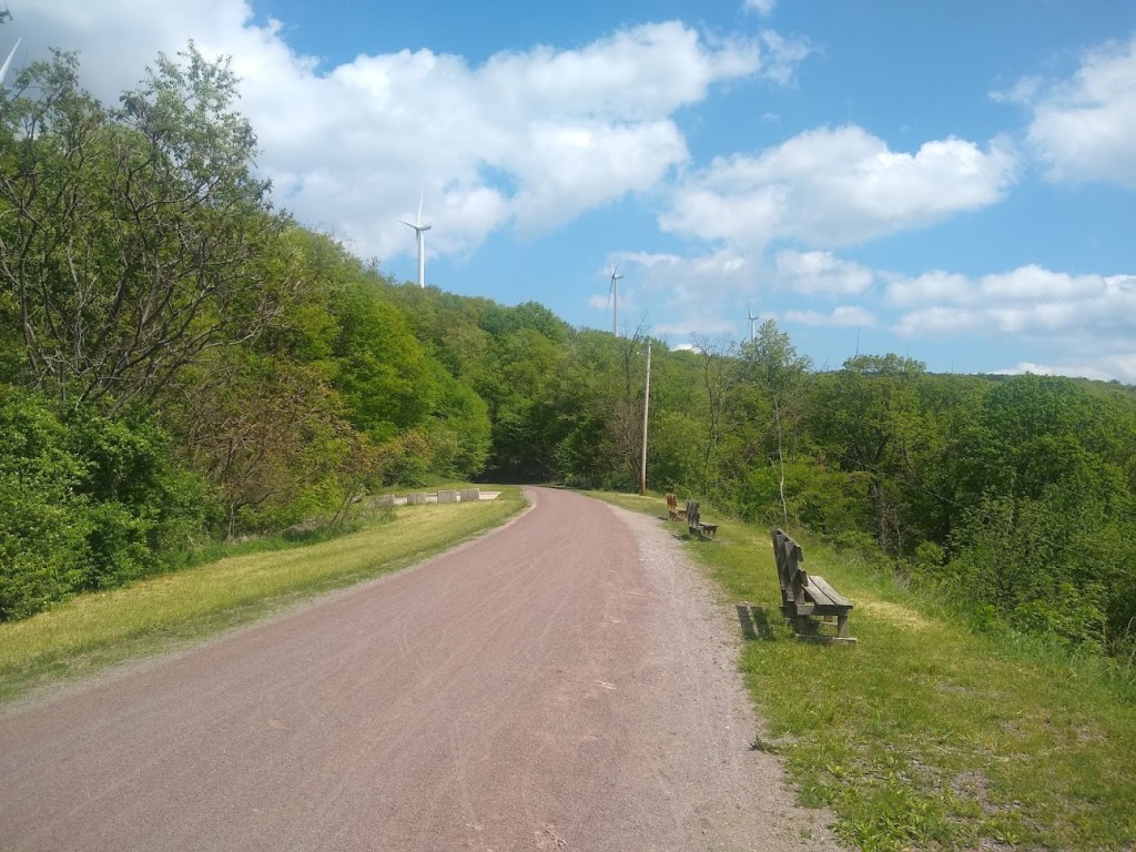
About 50 feet after the line, at the overlook, you can see the windmills clearly on top of Big Savage, and the breeze gets more intense. You can feel how close you are to the top as the trail veers off towards Big Savage Tunnel.
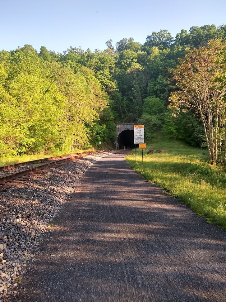
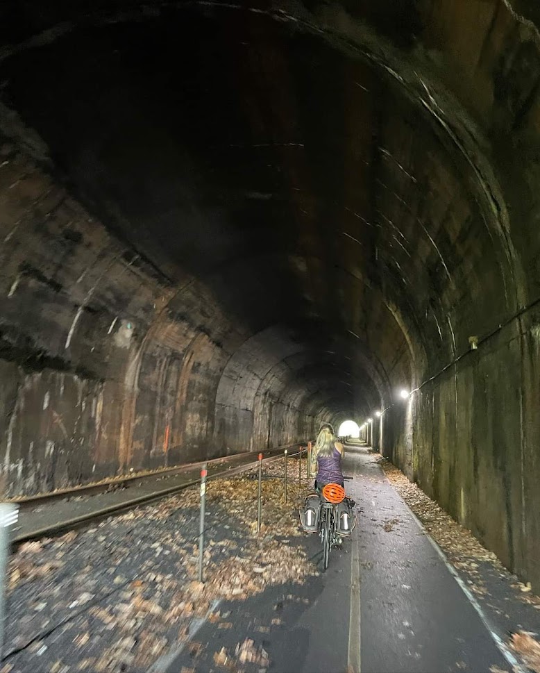
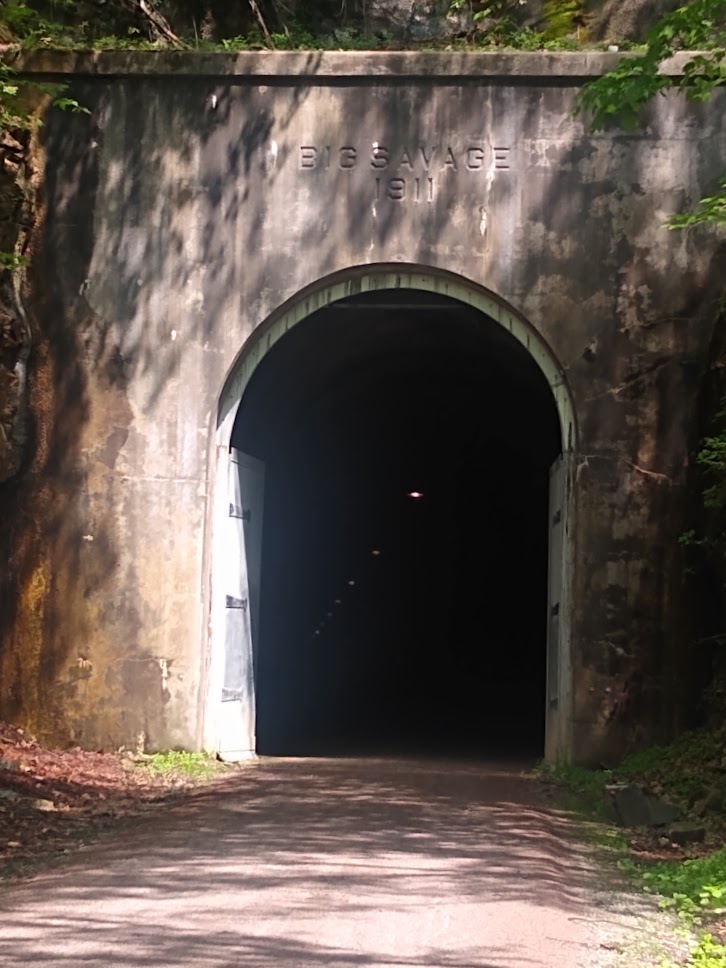
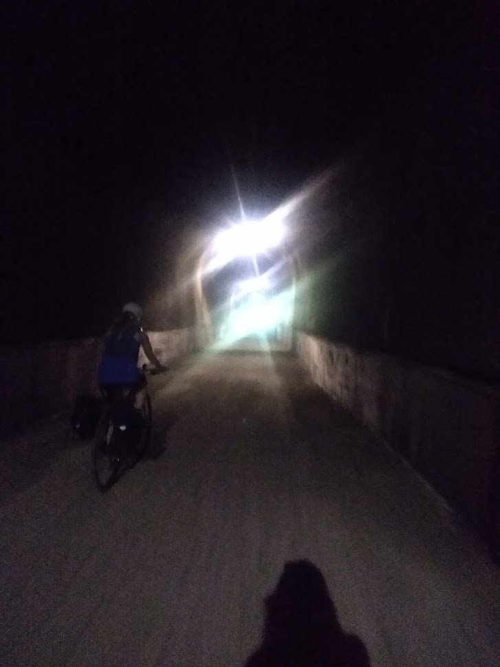
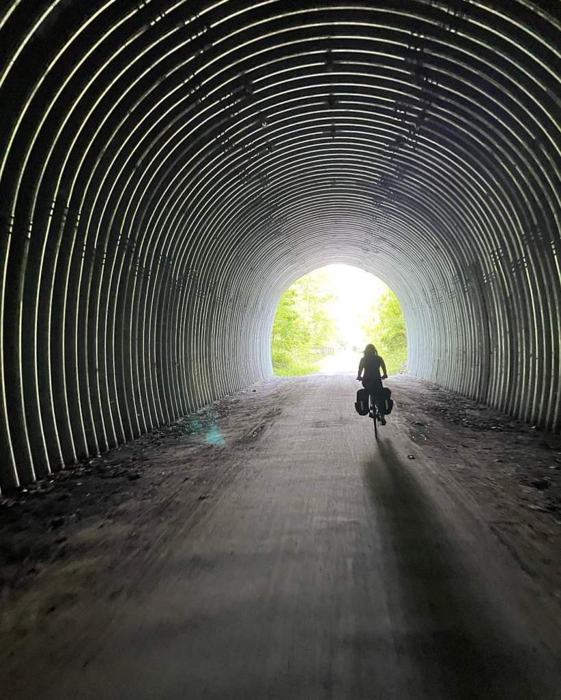
In May of 2015 when I completed this trail the first time, I had the opposite weather problem: I was freezing my metaphorical nuts off. It was rainy, windy, 38 degrees, and I couldn’t wait to get to Big Savage tunnel for cover. I had read about it, knew it was about a mile long and I was so looking forward to a bit of warmth and a chance to dry out. I rounded this same corner praising the gods that I had finally reached shelter. I immediately took that desire to enter the tunnel, back.
Big Savage, as it turns out, is a big fucking savage. Simply standing at the entrance you could hear the wind whipping through and shooting out the other side onto my already freezing face. I entered, reluctantly, and I can promise you had there been any other way to the other side of that tunnel that made any sense whatsoever, I would have taken an alternate path that day. My circumstances before entering seemed like a pleasant dream during those 3,295 feet. Pedaling into the wind whipping the frozen mist over my entire body, I just wanted a warm tea. I would take my previous conditions back though, without complaint. Exiting the other side, I was grateful to have a moderate breeze, 38-degree weather, and “just rain” again.
Flash forward to 2022 and I was hoping in this weather there would still be a chill in the tunnel. And there was! This was by far the most refreshing part of the trip (yep, screw the beds and fluffy pillows that come later – big savage was my bestie this year). Going from 95 degrees to whatever-it-was in the tunnel was absolutely wonderful. In contrast to 2015, this year nothing on the rest of the ride was quite as refreshing as Big Savage.
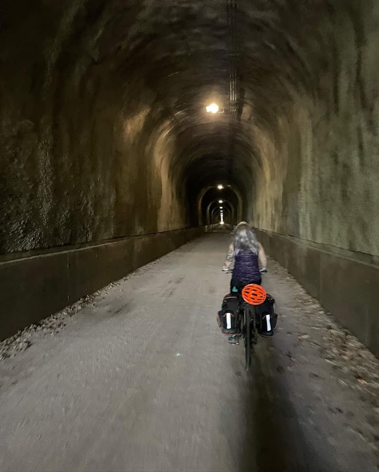
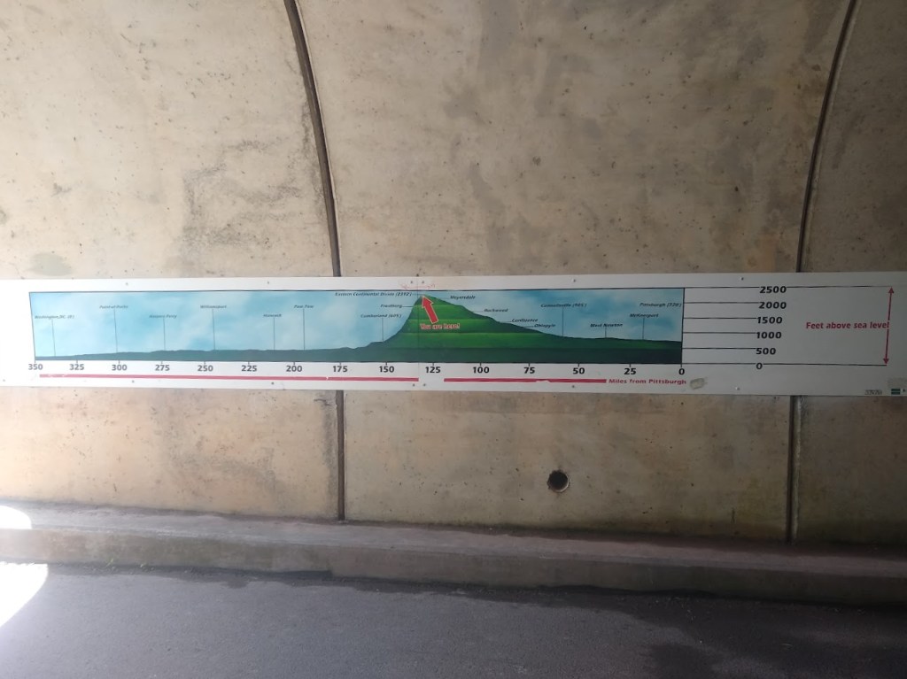
After that, my memory said “it got easier” but it didn’t make sense until the Continental Divide. Maybe because both times the tunnel represented one form of relief or another: Either a chance to cool down from the heat or a chance to better appreciate the weather you already had. After the tunnel, it didn’t feel like the last smoldering 20 miles. And it just got easier when we reached the divide.
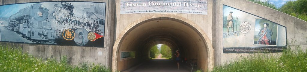
We weren’t the only ones that felt the pain of the mild and long elevation change though. Someone (clearly travelling south), on the inside of the tunnel at the Continental Divide, has drawn sad and happy faces on the elevation profile posted there. The mileage between here and Rockwood, where we were staying at the hostel, were much easier miles. We took a moment to rehydrate, refuel and enjoy a few moments.
And with that….we were headed downhill, not pedaling at times, like all those douchebags we saw on the way.
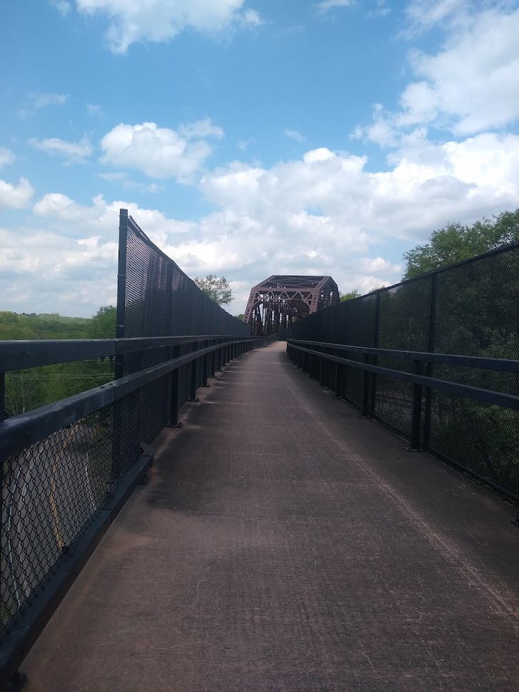
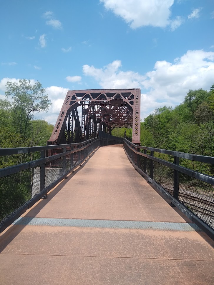
Keystone and Salisbury Viaduct, Meyersdale
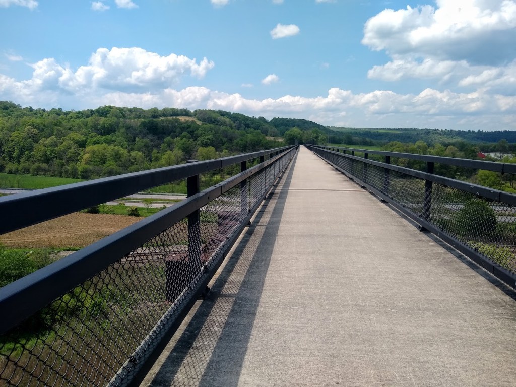
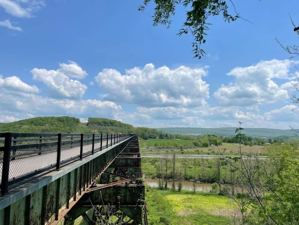
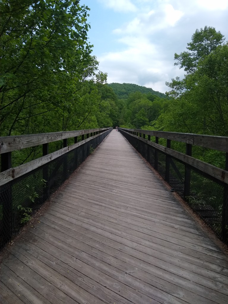
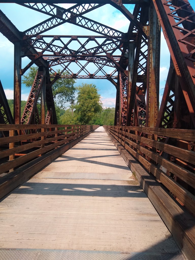
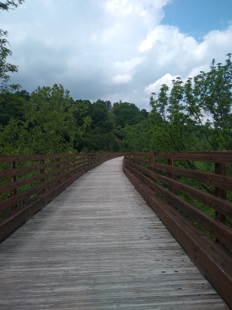
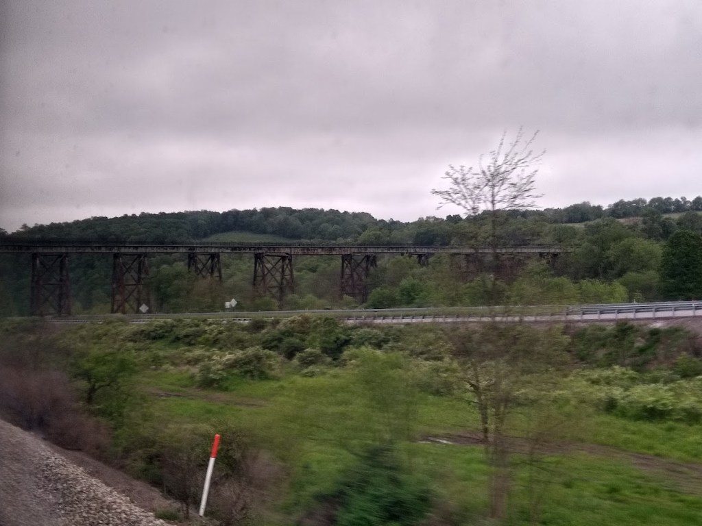
Around mile 30 there’s Keystone Viaduct, and because we were now coasting along just fine, 95 degrees was an afterthought. There’s so much to see. The viaduct here is pretty long, and absolutely gorgeous (and if you’re taking Amtrak back you’ll get to see it again), you get a last view of the windmills on Big Savage, and you’ll coast onward to Meyersdale.

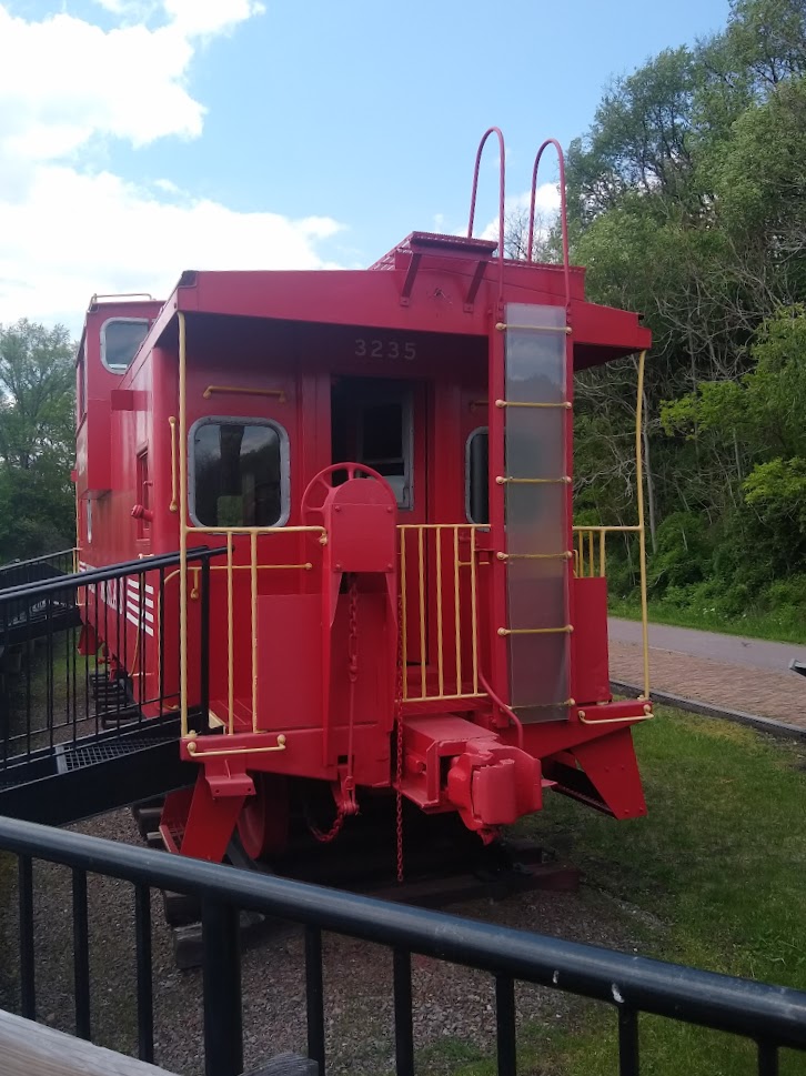
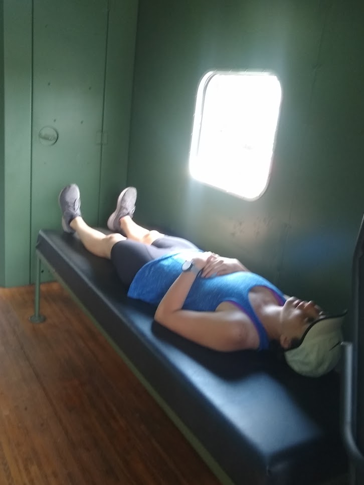
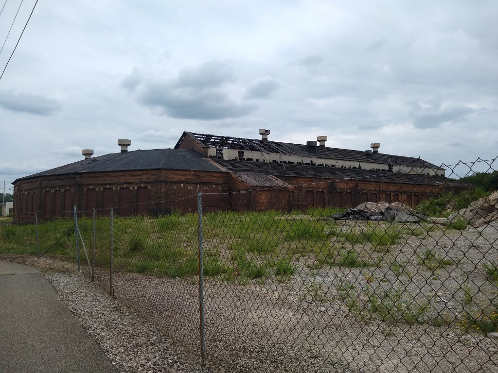
As good as my memory is from my last trip – I had no recollection of Meyersdale. I assume I was too cold and wet and thought it best to press on and find shelter. This time however, we got to enjoy the adorable station, giftshop, and museum. There’s water bottle fill up stations/fountains, actual bathrooms (with plumbing), a merch shop, a caboose to explore, ect. The train museum has a lot of neat artifacts and history, as well as model trains/towns.
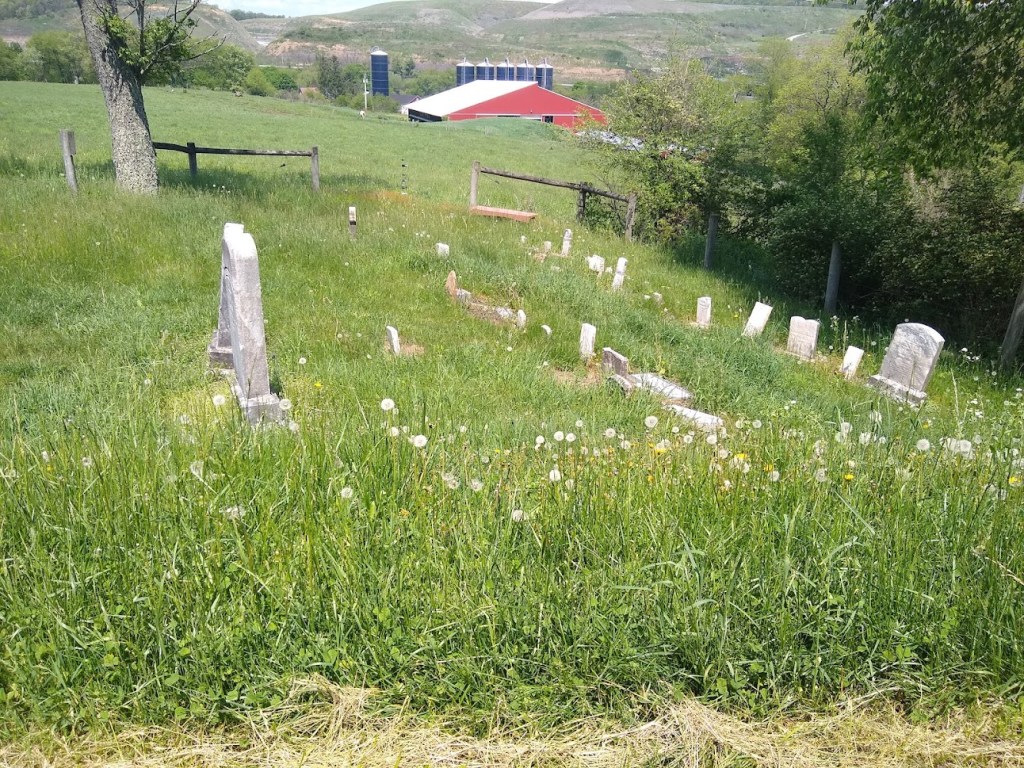
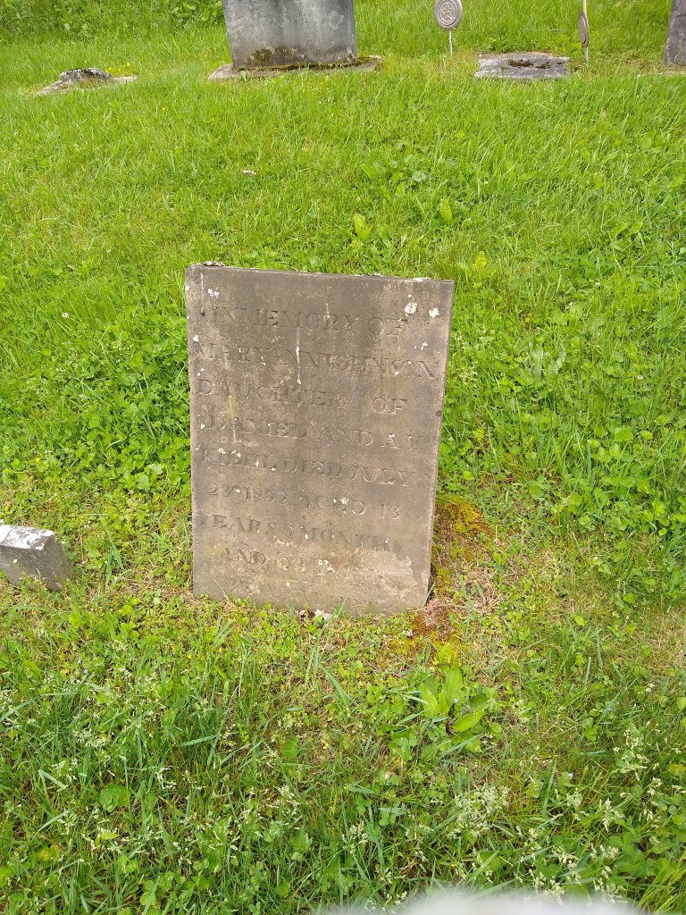
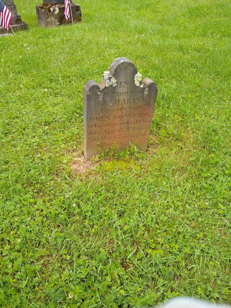
Shortly after Meyersdale, we crossed the Salisbury Viaduct (I feel it’s a missed business opportunity not to have a Salisbury steak stand here but whatever). This viaduct was notably higher than the last, crossing the road, some fields and a river. The views were amazing and after crossing there’s a little family graveyard off to the right-hand side.
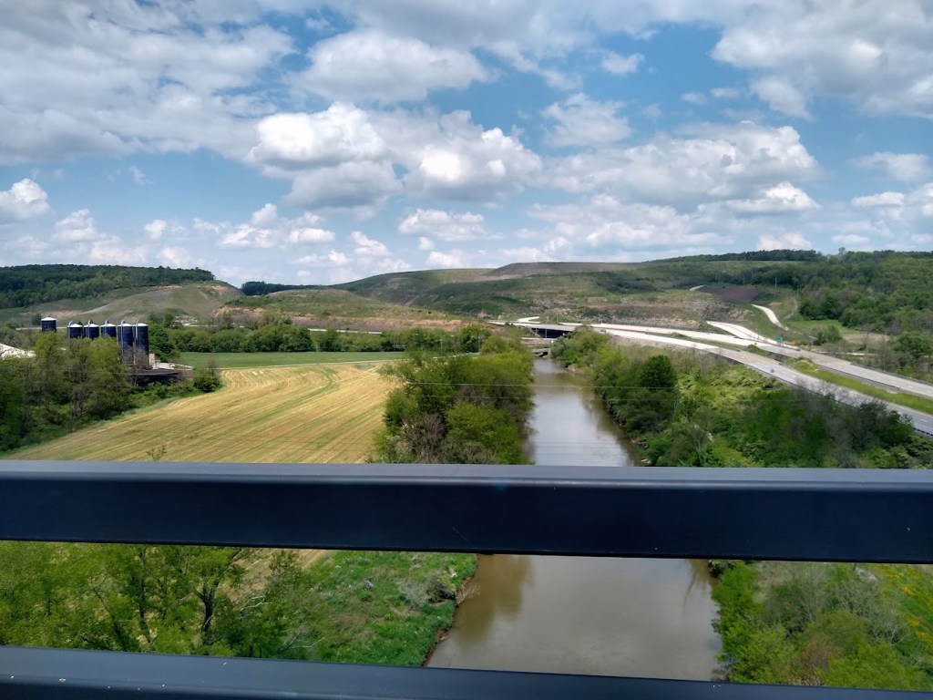
Mile 43.5: Reaching Rockwood, PA
Rockwood (43.5 Miles) was our stopping place for the night. (Water is available at this location, on the trail) Or in this case, remainder of the day – we actually made pretty good time. The journey from Mayersdale to Rockwood can legitimately be described as a wonderful “coast”. The last 15 miles flew by for us even in the scorching heat as the morning had conditioned us for uphill-in-95-degrees.
We checked into the Hostel on Main, which is a short climb off the trail and across the bridge. I stayed here in 2015 as well, and it hadn’t changed much. Our appetites had kicked in and after a brief search for a facility that would support our ravenous hunger (one pizza place we had our hearts set on was closed) we found Rock City Café.

My body tends to have very specific cravings towards what it needs to replenish. So, I feel my choices of a meatball sub and a small pizza (both of which I would split and save for later since it was early in the day) and a salad were very logical. Jenn, on the other hand, kept it simple by ordering the entire menu. Medium pizza, bread sticks, and many others. Which were all fantastic, and as I was invited to munch (and didn’t decline of course), I now know that absolutely everything on the menu is delicious.
We returned to the Hostel and showered after destroying the food selection. The facility is so, so clean, and showering is such a marvelous thing after a day like that. They ask that you limit total bathroom time to 10 minutes as everyone has to share 3 bathrooms (I’ve never seen more than 3 people here anyway but it may just be my timing). If I were to have a complaint, which I don’t, but lets make up one – cell reception isn’t the best. Truthfully I don’t want much of anything to do with the nonsense of humanity when I’m on a trip like this anyway, so not being able to get ahold of me was more of a plus. You’re not calling anyone and that same “anyone” isn’t calling you. They do, however, have free wifi.
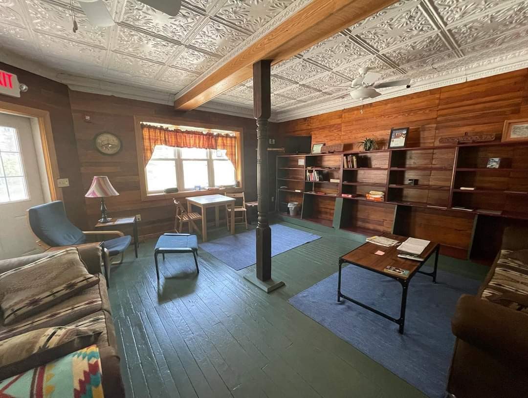
They do have a communal living room, a really cute kitchen, linens can be rented (I had a sleeping bag but for like $6 I’ll be lazy and not unpack that – time is of the essence). We had one bunkmate named Monica who was a beast and I’m still trying to figure out if I can stalk her down on Strava. The new (at this time) Dollar General is really close, and you can re-stock your pannier food stash and/or just continue to watch Jenn raid any and all food supplies in general (I was really wondering who was the pregnant one on this trip, guys).
Yet again that night, sleep didn’t come easy. Instead of sleep I craved exploring stupid shit in the building. Like looking through the guestbook to see if I could find my signature from 2015 (I did – kind of – I know it was me because the pen was running out of ink and it’s half completed) and sneaking around the hostel trying not to make the floor squeak and wake Monica. Around 6am I was going to start packing but I felt like a douche for making noise so I ate my other half of a meatball sub for breakfast and when Jenn woke up, my ass was still trying to pack up quietly, but we were out by about 7am.
Sarting Day 2
The weather Sunday morning was so, so nice in comparison to the previous day. It was supposed to rain later that afternoon, and I spent most of the previous night obsessing over not wanting to stop at Mile 89 the next day as I wanted my last day to be the easiest, but I was working with limited options.
I could either set up camp early enough it wasn’t an issue and exist on protein bars and other snacks (a thought I’m not completely opposed to) or find a place to stay and spend a stupid amount of money on. Obviously, I’m not opposed to rain either, but I hadn’t planned as well for the torrential downpour that suddenly appeared on radar this year. I made reservations, reluctantly, at a Comfort Inn that was close to “real food” options in Connellsville.
A side note – Lenora’s B&B in Perryopolis (which would have put me at mile 102 for the night) has to be one of the rudest experiences I’ve ever had in terms of me making a simple call to figure out what check in policies are. The “gentleman” seems to have a lot of displaced anger. And to be fair – the Silence of the Lambs house (the actual house) is one of the only other facilities there to rent there for an overnight stay so maybe he is tired of bike questions or maybe he didn’t have enough lotion on his skin that fine evening.
I digress….
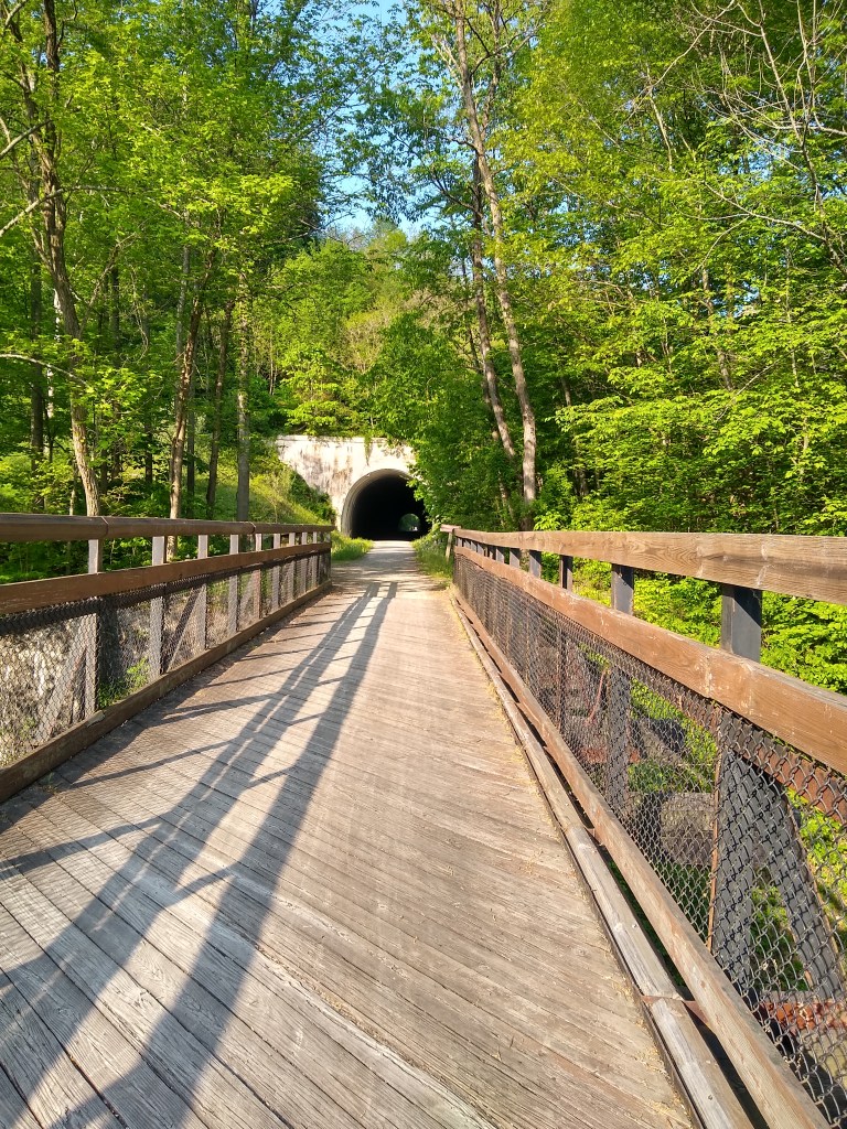
In 2015 Pinkerton Tunnel was closed and you had to detour around what they call “The horn” which was fine, and I’m down for a challenge, but it truly was a muddy disaster that year. But this time the relatively-newly-reconstructed Pinkerton Tunnel was open! It’s nice and cool and about as long as the Brush tunnel.
Confluence, mile 62, has portable bathroom facilities and water, as well as a few restaurant facilities. You’ll loop under the bridge (a leftward loop) and truthfully – had we not been on somewhat of a schedule due to rain and the shuttle, I would have liked to explore a little more. The town has charm and the people there were really friendly. This is also one of the only, very brief and mild, uphill sections of trail since the continental divide and you’ll find yourself mentally bitching over what is an embarrassing amount of mild discomfort.
Ohiopyle State Park and the Town of Ohiopyle
A lot of the signage would indicate, as well as the GAP/ C&O handbook if you buy one of those – I highly recommend even if you just use it as a preparation tool and don’t necessarily carry it with you, that Ohiopyle is around mile 63 – and it is – but keep in mind this is where you enter the state park – not where you enter the town.
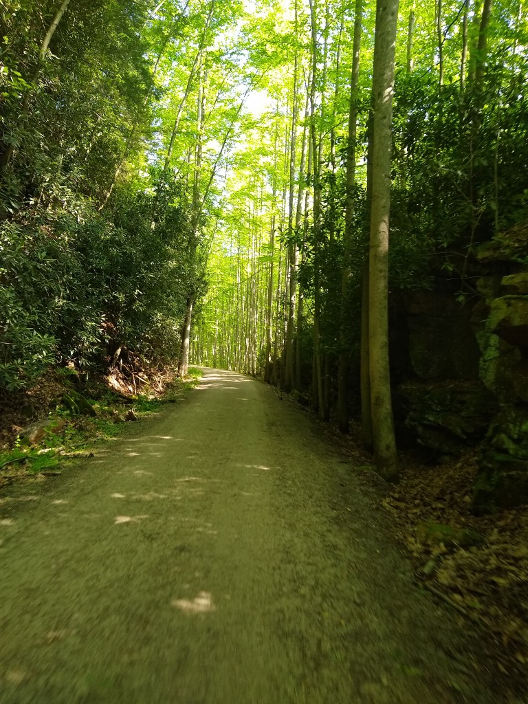
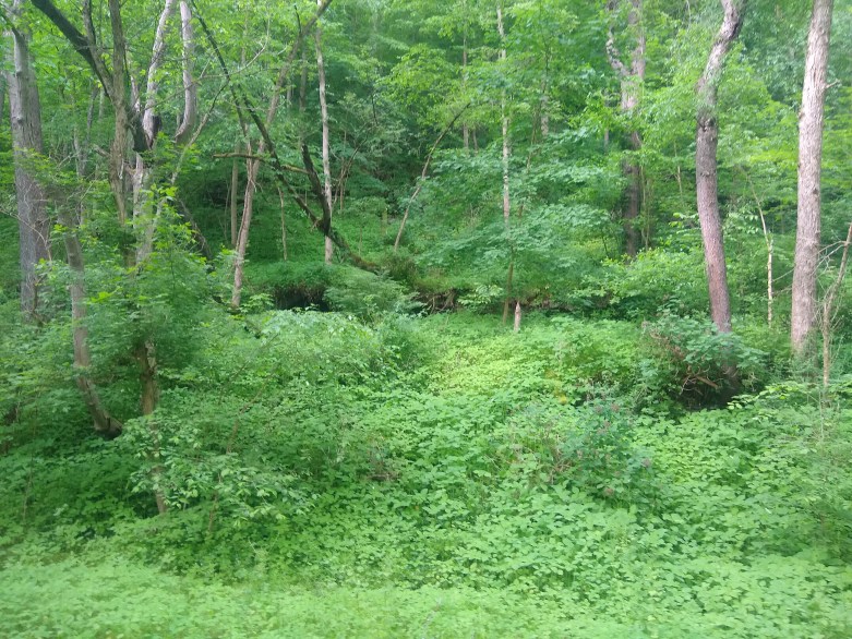
The town itself is between mile 71 and 72 so the park itself is rather large. It is, nevertheless, an absolute gorgeous 8-9 miles of forest. We rode under a green, shady canopy for about an hour as we took our time to stop and enjoy the forest around us, as well as some of the sights and historical signage.
When actually entering Ohiopyle the town I was met with a familiar sight. I’ve been here more than a few times both for the GAP and for standalone vacations – this place is amazing. The town sits in the valley with the campsites located on the mountain above. It’s easy to get lost and spend a week here. Cucumber Falls and Natural Waterslides are both as gorgeous as they are unique (too far off the trail for me to venture this time). The visitor’s centers (two of them) both for the GAP and for Ohiopyle itself are a wealth of information. The Visitors Center for the GAP has the usual stuff (water, snacks, souvenirs).
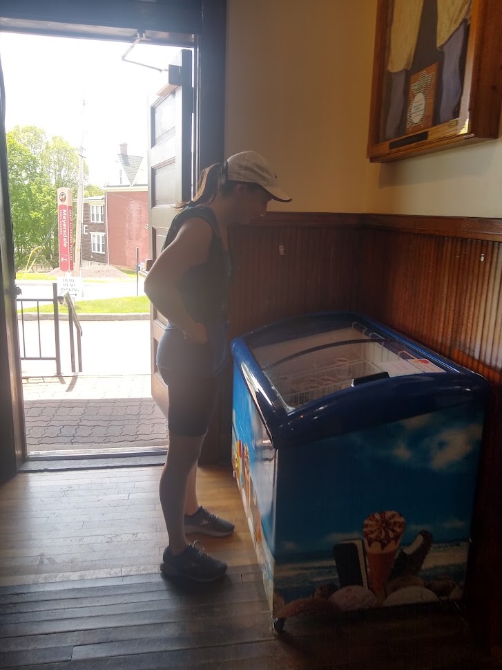
They probably have more than two restaurants, but I’ve only ever been to two: Falls Market and Ohiopyle House Café (has an outdoor seating option- I’m always a fan of this and a downstairs bar). There’s plenty of places to grab food, a water, souvenir, and if you like dairy the way I do – a milkshake or ice-cream. Circle around the GAP visitor’s center and under the bridge to cross the river (bridge is bike friendly) to Wilderness Voyagers for a shuttle, snacks and other supplies and gear.
Sadly, it was here that Jenn left for her shuttle, and I ventured on alone. We stopped for a snack from our panniers and as I accidently dropped food on the ground, I heard some of the most sound advice my sister (or anyone) has ever given me:
We are a society that licks each other’s genitals and here we are – we won’t honor the 5 second rule. It’s fine, just eat it.
Jenn, making sense.
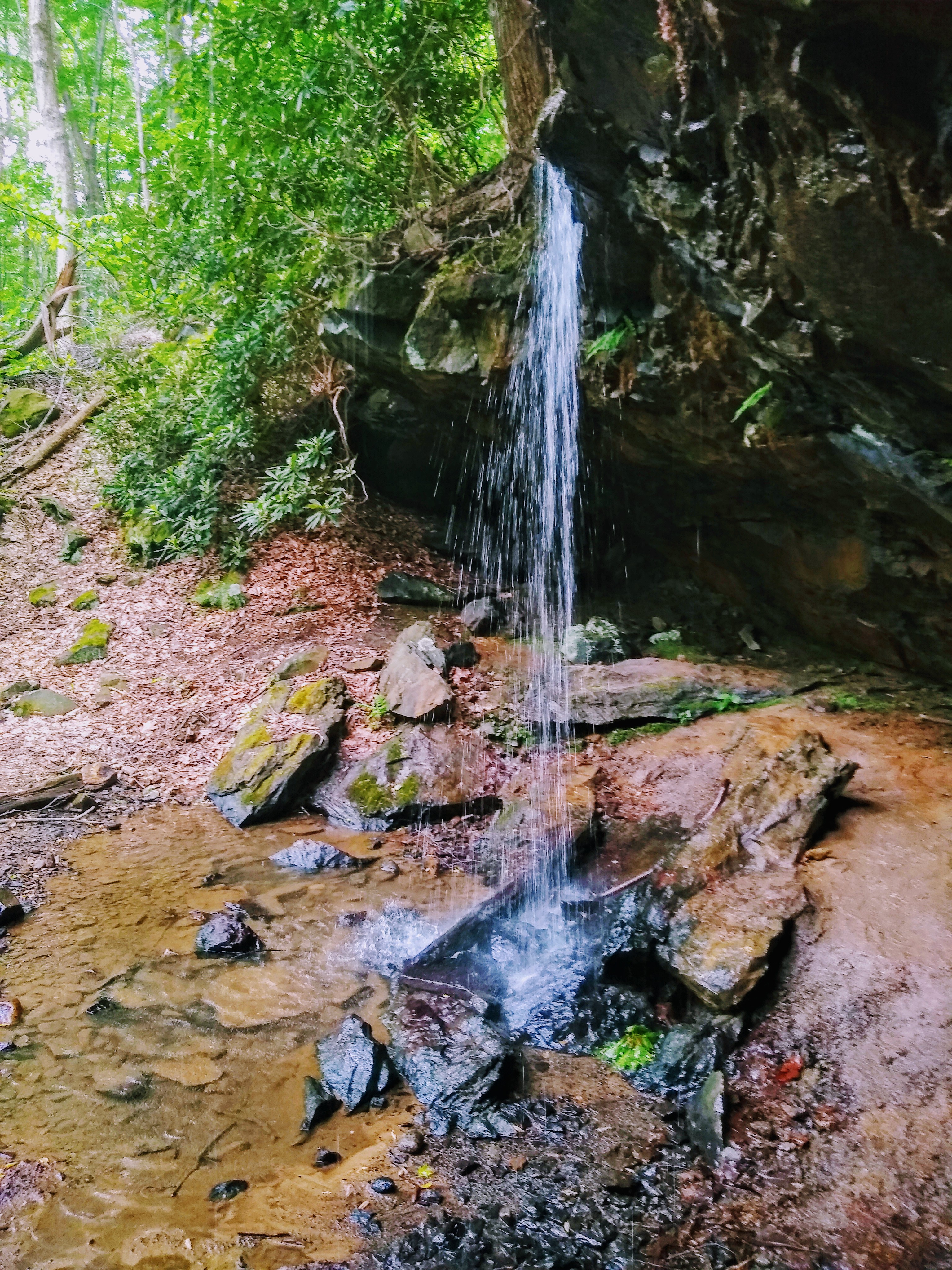
I’m inclined to believe the north side of this park is more beautiful than the south side. However wonderful both sides are, it’s the north side that has historically captivated me every time. The green everywhere looks like someone slid the saturation bar to the right a little too much, but it’s real. Deer and other wildlife are common, springs coming out of the side of the mountain above you, small waterfalls, ect make this an incredibly serene place. There are so many trails back there (some bike friendly, some not) and you could easily spend a week here and not see everything.
The springs though, those will knock you into another dimension. It’s a shift into an entirely different realm. The cool spring shooting out and cascading down the incredible incline of the mountain beside you as you ride by, feeling the cooled air and smelling the forest smell in a way that wasn’t as potent before. It’s truly a meditation.
You go in and out of this experience for miles. You hear it first, smell it, feel the temperature change hit your skin and your entire body is immersed in this sensory perfection. (Side note If you haven’t read “Nature Fix” or similar books on how these things affects us on a biological level you should).
I was absolutely awestruck riding through a comfortable canopy of green. It took me forever to get through here as it was an a completely immersive spiritual experience. Every part of my being was reluctant to leave it behind.
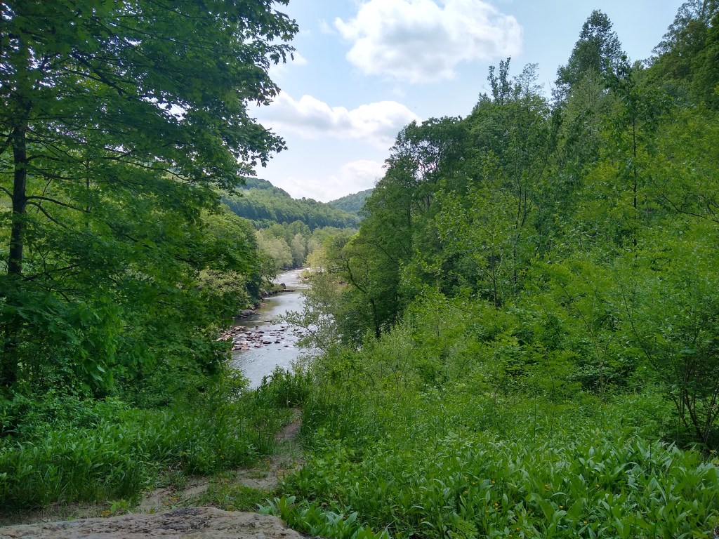
The Youghiogheny River Gorge is a few miles outside of Ohiopyle. I forced my mother down the trail one time to this spot (oops, I think she liked it though), and while it was a little overgrown this year it still is a great view of the river.
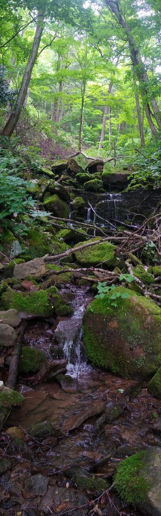
While there are many small waterfalls along the way, one of the larger ones is a noticeably nice rest stop and stop I did. I sat near and under the falls just before I reached Connellsville, knowing that was the last view of the Ohiopyle forest I’d get. It’s pictured to the right.
Connellsville, PA
The entrance into Connellsville (around mile 89) definitely has a different feel. Easy, meditative state isn’t necessarily a thing once you coast into town. Up until this point towns seem to blend with their surroundings and Connellsville always feels more industrial to me. Though it doesn’t start out like that immediately, I knew when I had hit town.
All of a sudden there’s pavement and stoplights. The trail is well marked and runs parallel to the road, so I was fine both in 2015 and this time traversing these roads without feeling lost, unlike later in McKeesport (more on that later…).
Even if I didn’t want to, I rationalized that Monday, my last day on the trail, was an incredibly mild clear day. Therefore, stopping in Connellsville at the Comfort Inn (mile 89.9 which I could mentally round up for sanity-sake to 90) wasn’t an awful decision. I also rationalized if I kept going there’s no way I was ordering any real food to my campsite so this would have to do.
Stopping here conflicted with more than just my plans though. I’m usually an avid camper. Religiously I preach to others that it’s sometimes free, or cheap, and it accomplishes something hotels don’t- really bonding with nature. Backpacking is a favorite pastime, but even on family vacations in my massive family tent with blow up mattresses you still bond more with your surrounding and have a chance to “unplug” in ways that otherwise you probably wouldn’t.
Since about March I’ve had annoying and recurring sternocleidomastoid issues that haven’t seemed to completely go away. I can also probably chalk this up to a “weird pregnancy thing” but let me tell you – it’s painful and incredibly annoying. I hate to puss out, it makes me angry, it makes me feel like I’ll choose comfort over adventure – but all factors considered – stopping here was probably the better choice. It gave me a chance to recharge and make sure I could fully enjoy the next day which truthfully, was my purpose in the first place. To be present for the entire trail.
Having all that said, and not to sound spoiled by modern day comforts, this has to be the nicest hotel I’ve ever stayed in. They were packed the previous night and I was way ahead of check in time, so I just waited at Yough River Park (which is practically the hotel’s back yard) and chilled on the benches, under the pavilion, and somehow dozed off on the picnic table. The trail does pass thorough here anyway so if you need water or food there’s a fountain and a cash-only food stand.
On check in I was pleased with luxuries such as the fluffiest pillows I’ve ever seen, rooms / elevator big enough to accommodate my bike, usb charging ports, vending that actually worked (that included a chilled protein bar), a very very fancy evening bar in the lobby pimped out with underglow (think alcohol-type-of-bar – I’m from a small town and this is foreign to me. When they said “bar” I thought “cinnamon buns” like on the continental breakfast).
Starting Day 3
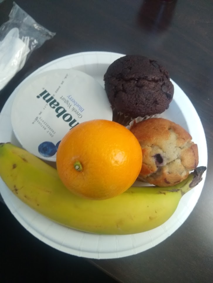
This place also had the hands-down nicest continental breakfast bar I’ve ever seen. When I worked at hotels in my teens “breakfast” meant apple “juice” ( translation: a substance that would make you shit your pants…perhaps at work) the aforementioned cinnamon buns, maybe a plain bagel and something that said “butter” (but I wasn’t sure), and if we got real fancy we got something that said “jelly”.
This place? A mini fridge full of yogurt and hard-boiled eggs. A window with a human being making scrambled eggs and sausage, the proverbial “juice” machine, muffins (chocolate and blueberry), 3-5 types of artesian breads, bagels, coffee, cereal, blood oranges, bananas, apples, cereal, coffee, ect. I have never seen that variety at a Comfort Inn (Given, I rarely rent hotel rooms). What I was less impressed with was the woman on the elevator who didn’t think I needed two muffins for breakfast. Don’t prejudge my breakfast rude elevator lady, my caloric needs are far greater than yours will likely be today!
I said goodbye to the breakfast bar and scooted outside. It was notably cooler than the previous two days – a very satisfying 63 degrees. Re-breaking-in of the ass on day two is always a struggle unless you cycle enough that this doesn’t happen (if your ass doesn’t hurt after 100 miles on mildly bumpy terrain, you’re either doing it wrong or doing it too right, I have no idea which of the two your problem may be).
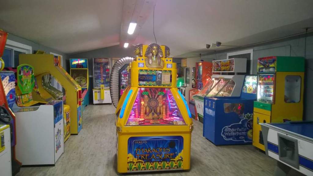
I passed the Uniontown KOA where I had stayed last time, about 2 miles north. One of the coolest KOA’s (though, no adult sized jumping pillow. Boo!). They had an arcade and a plethora of other things to amuse me. Though, to be fair, the goal was to stay outside and away from technology so I’m not sure how useful that actually was – but it was cool anyway!
Just past the KOA you’ll see signs for “coke ovens” (about mile 93) which are by far one of my favorite things in the area. If you look up in the hillside to the left, you can see an abundance of small structures and ruins that go on for about 1/2 to 3/4 of a mile. There’s a few informational plaques that explain the process of turning coal into coke, and the significance of the thousands of ovens, before you get to the area.
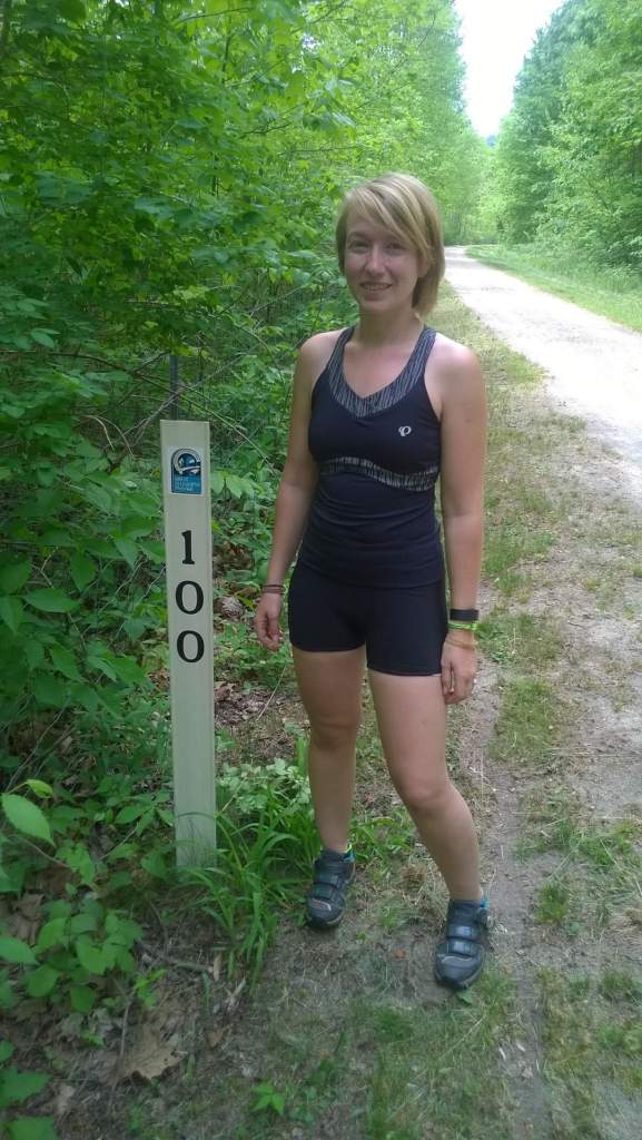
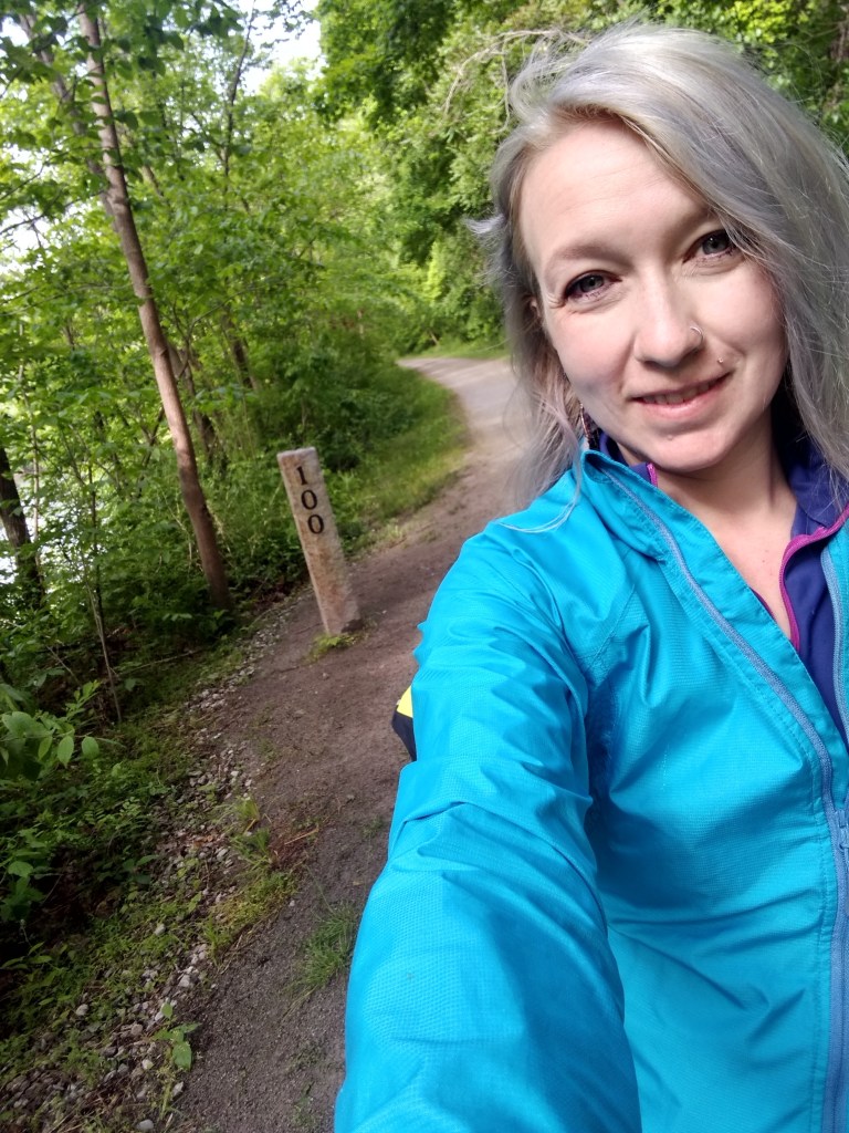
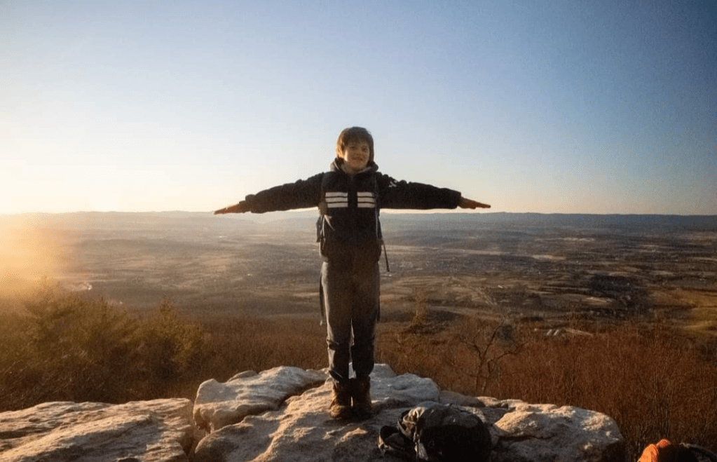
Mile 100!
Around mile 99 there’s a really cute campsite named “Roundbottom”. It’s a free campsite with primitive facilities. And of course, shortly after that you’ll have a selfie opportunity at mile 100 because now that the mile markers have 3 digits you have to!

Before I left Connellsville there was a sign that said it was the last water before Whitsett. I’m not sure what I was missing but there was no water that I could find in Whitsett (at least not from a fountain). There was, however, a stand with free water and snacks for hikers and bikers. Not sure if this was set up in lieu of water that was maybe out of order or just by a good Samaritan, but it was super, super nice. I didn’t need it that bad that morning, so I skipped on it, but it was a very cute stand in a cute little town.
In Van Meter you’ll pass a memorial for the Darr Mine Disaster. I didn’t have time to stop this particular morning, but a quick Wikipedia search will tell you all you need to know (or at least enough to wish you had stopped). Apparently, this was the worst massacre in PA history? According to a few sources there’s a lot of company houses still intact (though I didn’t see any) and there were more than a few things that were clearly left over from the mining industry.
I stopped in Smithton that morning to eat a snack and some energy chews and enjoy the weather. Smithton doesn’t show up on a lot of guides, but I feel it should. It’s a nice, scenic stop if you’re not going off trail. There’s a fountain/bathroom in the parking area, some benches that overlook the river, ect. Even if you are going off trail, there are hotels and other food/water sources nearby, within 2 miles. The sign warns to use caution if you’re going to cross the bridge, but the accommodations I originally looked at were not in an area that required bridge-crossing.

One of the things I was most impressed with, and truly have little recollection from the 2015 trip, was Cedar Creek Park. This was a enormous camping/recreation area in comparison to every other one I passed on the way (before and after). It’s at mile 110 and I absolutely plan on going back for a family overnighter. You can camp right beside the river (within reason). They have water, bathrooms and it seemed to be a visitors center (closed at the time I rode past – not sure if it’s open for anything other than special occasions?). I didn’t feel I had time to stop here this particular day but I definitely slow coasted to enjoy the scenery.
You can view information about it here.
West Newton, The Red Waterfall, and Dravo Campground
I do remember stopping in West Newton in 2015. Mainly due to the conveniently located pizza place across from the visitor’s center that I refueled at. My memory of the place said “it was the best pizza ever”, but to be fair, they’re 30 feet from the trail and automatically at an advantage. This visitor’s center (like the others) has a gift shop, water, restrooms, train car to explore, ect. West Newton is where you start feeling like “you’re close”. The distance to Pittsburgh on the signage starts to look a little less daunting, and the scenery has some subtle changes. From here on out there’s increasingly more intersections and small towns.

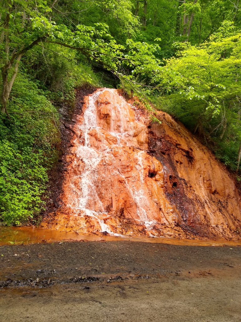
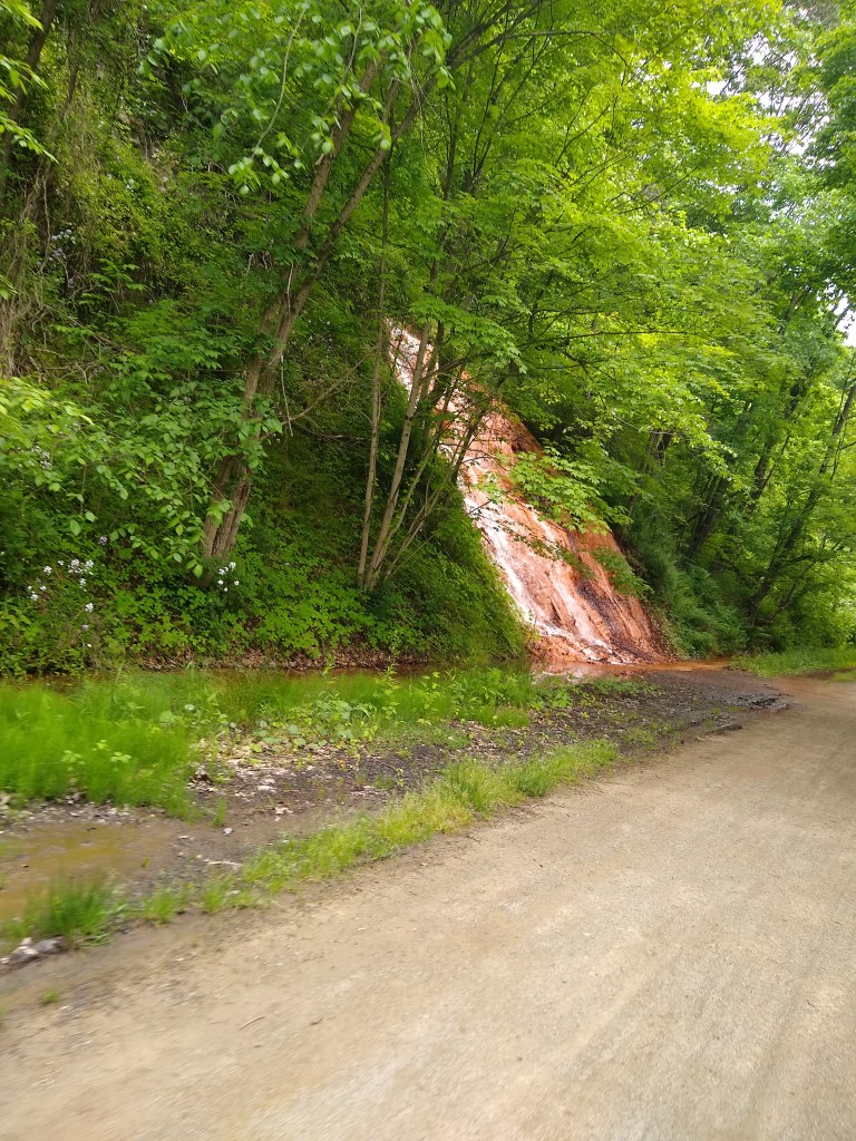
At mile 119, there’s a red waterfall, appropriately named “The Red Waterfall”. There’s a worn information plaque here that explains how the waterfall formed (and that it’s red due to the iron rich ground it’s flowing out of). It flows, rather quickly, beside the trail without flooding onto the trail both times I’ve passed it, and then under the trail through drainage pipes into the Youghiogheny. The scenery here has turned, albeit briefly, to an oversaturated beautiful green that’s contrasted perfectly by the red falls.
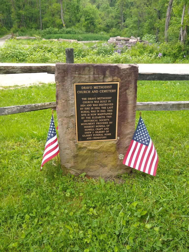
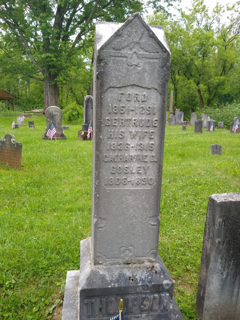
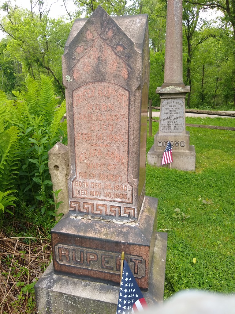
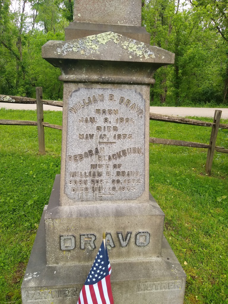
At Mile 122, there is by far the most unique campsite: Dravo Campground and Cemetery.
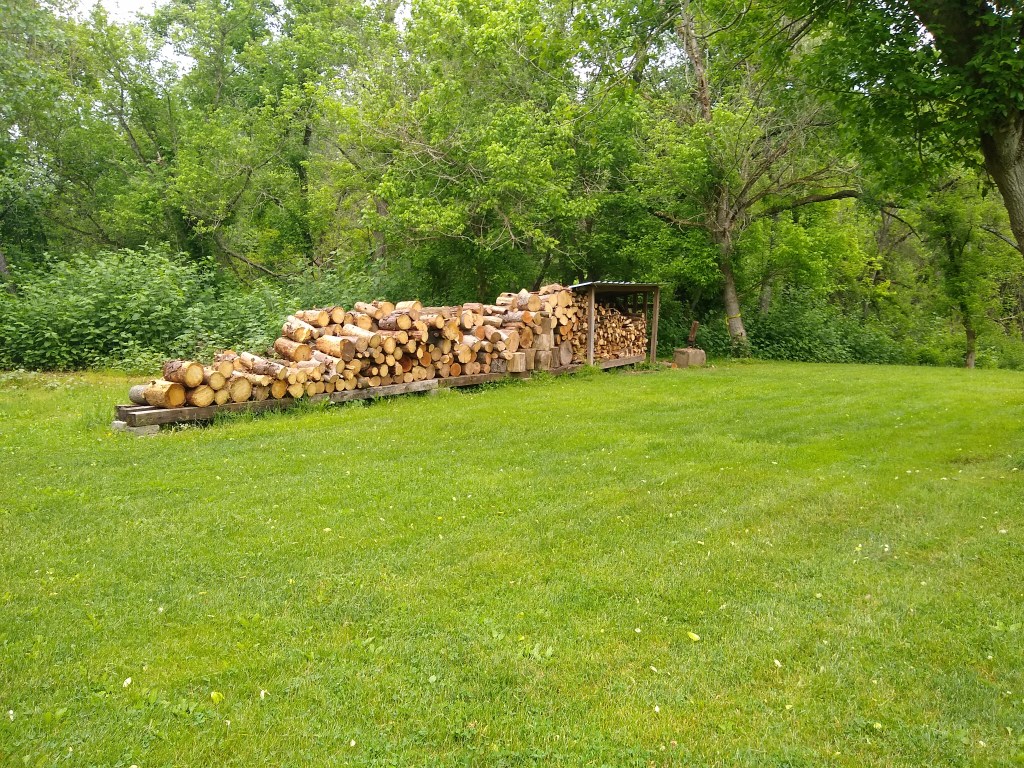
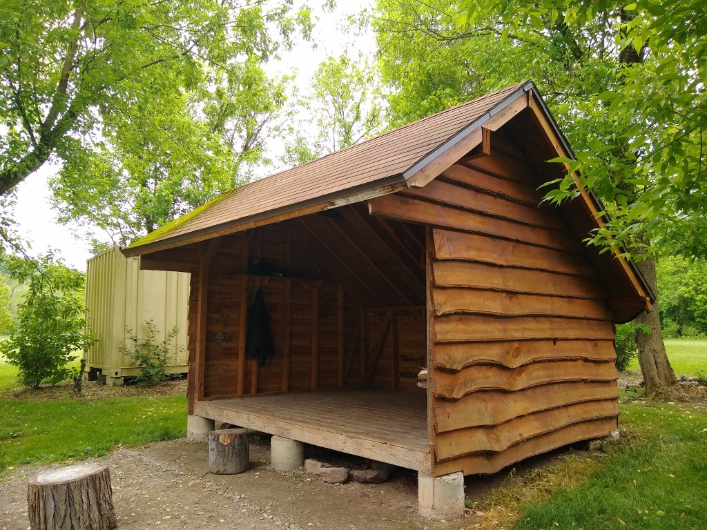
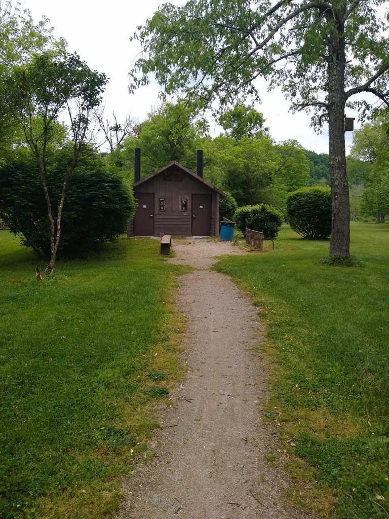
Dravo is actually really cool, and while I’m a bit creeped out about camping there due to the proximity of the cemetery (I know, come on Steph. Get over it), the facilities are really nice. They have a few shelters, a bathroom, plenty of camping space, a bit of forest, and you’re right along the river. The cemetery itself has a lot of history. If you have time to stop – you should. I paused here to eat and waited out some unexpected rain and explored the graveyard.
Boston, the last small-town-feeling
Maybe it’s because I’m a small-town lady myself, but I love Boston, PA. In 2015, sufficiently creeped out by the thought of staying in Dravo (which I again I recognize, is a sad, sad state for “adventure girl” to be in), I pedaled just a few miles farther north and stayed at an AirBnB here. There was, at that time, a place called Woody’s across the bridge (there’s a protected sidewalk for pedestrians) and due to being so far ahead of schedule that year I went multiple times and um…”refueled” with multiple drinks.
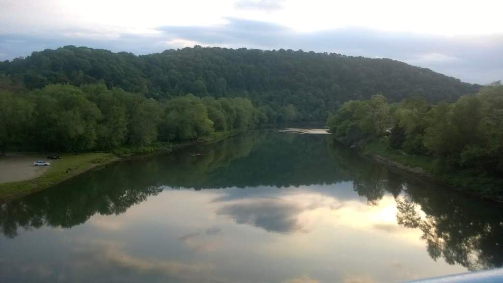

The view of the crystal-clear Youghiogheny from the bridge is unobstructed, making for a gorgeous sunset. The town is small enough that the noise of traffic isn’t any bother, and the people have, both times, been very welcoming and friendly. There are far more intersections here than you will have encountered thus far – but traffic is generally aware and will let you cross safely, yielding the right of way without a battle.
Unfortunately, this year I’d have to pass up most of the nostalgia I had for the town – but I’ll be returning with my +4 humans.
A few miles outside of Boston the trail is without a doubt changed – and permanently – for the more industrial side of things. Thats one of the best things about this trail. You get the meditative experience of all the forests, and it spits you out into straight up industry.
Riding past Dead Man’s Hollow Preserve (mile 128), this is the last glimpse of nature you’ll get (at least to this degree). This is seemingly a very large preserve (when I looked it up it said 400 acres – with an interesting backstory about the name). From here you have two things: paved trail and some (short) hills you had happily forgotten existed on this trail.
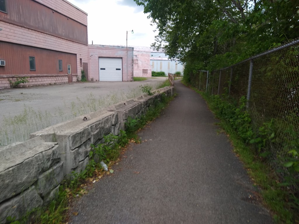
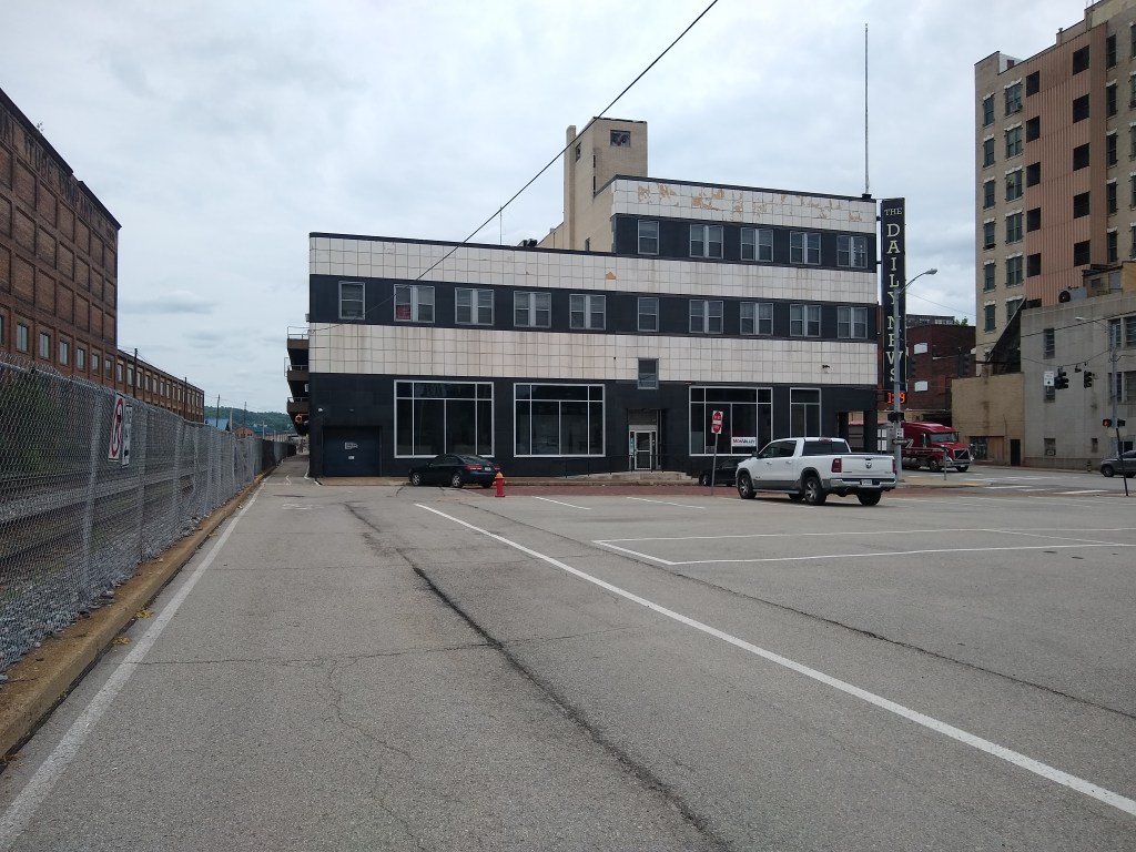
F*%king McKeesport
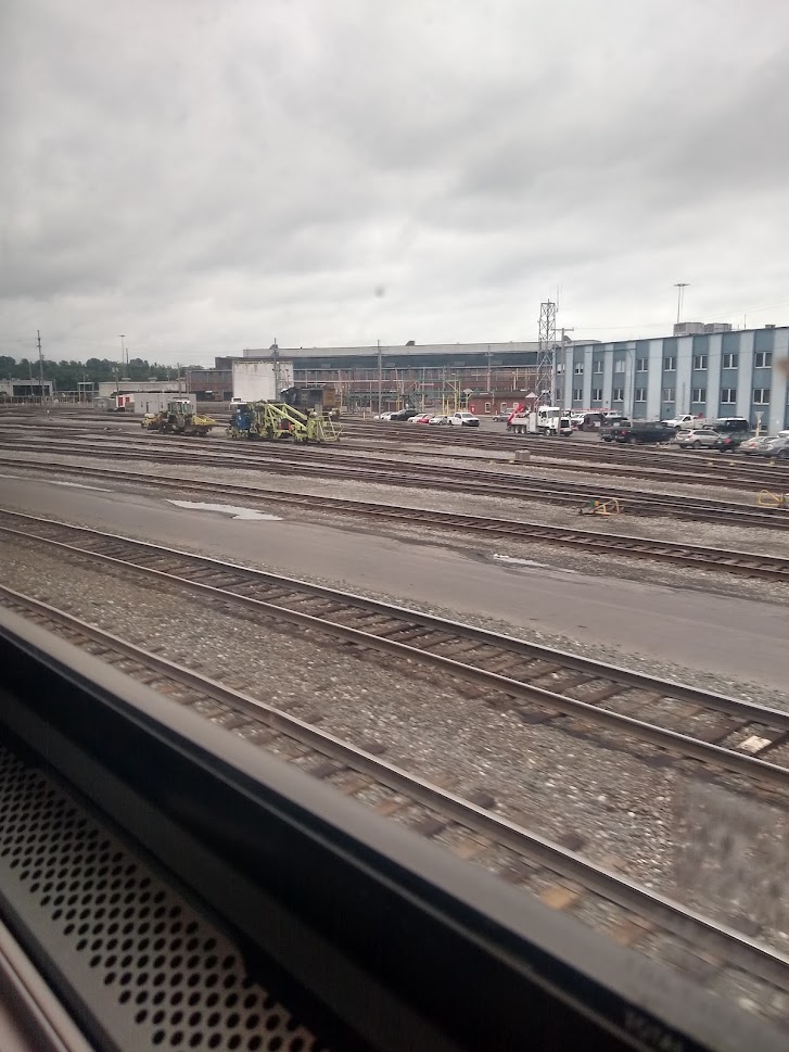
Then we come to McKeesport. And don’t let my description of this area deter you from doing the entire trail – but this place is something else. I remembered it well from last time. Mainly because I remembered thinking “I hope I don’t get mugged”. Up until this point every town I had ridden through felt “safe”. Given this was almost a decade ago, so I assumed my mind was exaggerating the level of “danger”, and in all honesty it probably was. However, here’s what to expect in McKeesport.
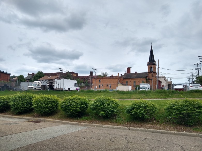
McKeesport is an old town with a lot of potential charm. The buildings and layout are reminiscent of Cumberland, MD but with an added uneasiness about it. Both this year and in 2015 when I made my initial decent on the trail, I kind of (for lack of a better term) got, what felt like, “booted off” onto the road which is fine, and if you’re not already wearing a helmet now is probably the time. However, while road riding is definitely my forte, the issue I had with it was the signage. At first I had little confidence that I was, indeed, still on the trail at all.
About the time I thought I’d check a map, or my phone, I saw signage. The road, indeed, is part of the trail and I hadn’t somehow veered off course. (Again, I don’t mean to sound like a little bitch but considering how well labeled every single mile is up until this point, it’s a bit disorienting.) After about a half mile I jumped onto what actually DOES look like (and is labeled as) the Great Allegheny Passage and climbed a short bit to a road crossing.
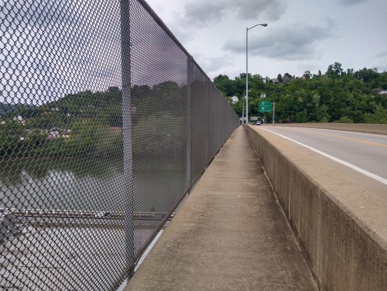
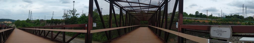
After crossing the road, the path really narrows as you cross the bridge. Due to an additional pedestrian I had to hop off momentarily, so it’s drastically narrower. There’s a chain link fence on the edge of the bridge where the protected pedestrian/cyclist path is. There’s a gap at the bottom of the fence that made my phone and my Garmin nervous but other than that – just glad it was a dedicated path/lane.
After crossing the bridge, I was on my way through town. Less guesswork here but you still have to keep a sharp eye for signage. People here are less inclined to engage you and that almost made me more nervous. I encountered a few homeless people, one was drinking (like day drinking) in, quite literally, the middle of the trail. These were the friendliest folks I encountered, and they helped me unload some of my overpacked granola that I needed to part ways with. The rest of the town was a ghost town.
Here’s a report about McKeesport that just goes to show you, gut feelings are accurate: Link

You’ll take a right, and eventually pass behind the police station in an alleyway. As you continue the trail is contained, on either side, by 8 foot chain link fencing. You’ll pass a few dilapidated buildings and then come to the Riverton Bridge out of McKeesport. It has a bit of a climb on one side if you’re heading north. It was here my Braxton-Hicks contractions returned with a vengeance. It’s not particularly hard, it’s just somewhat similar-to a HIIT workout. You’re really coasting and all of a sudden, you’re pushing pretty hard.
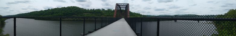
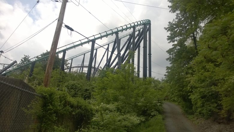
After you exit the town, there’s a few bridges that cross back and forth over the tracks as you get closer to Homestead, and a decent overlook close to the Kennywood Amusement Park (I don’t think there’s any signage for this but when I see roller coaster tracks, I have to know- so just FYI. Kennywood.)
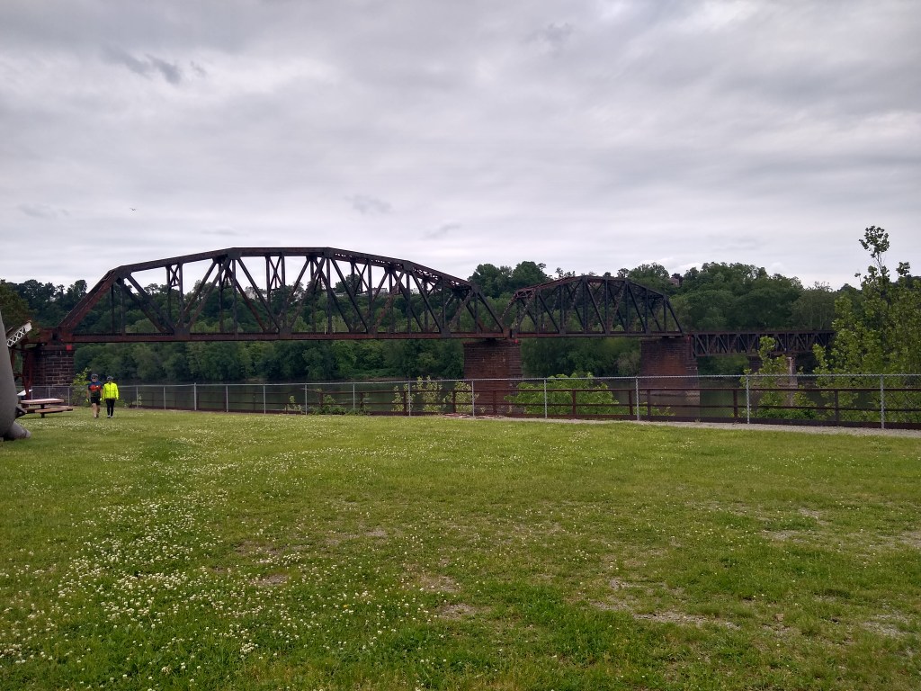
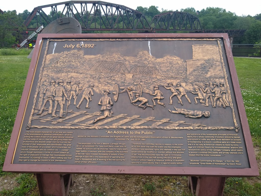
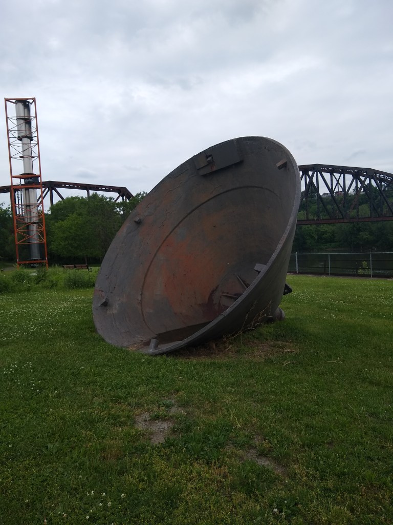
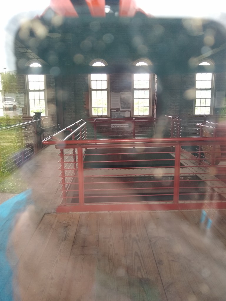
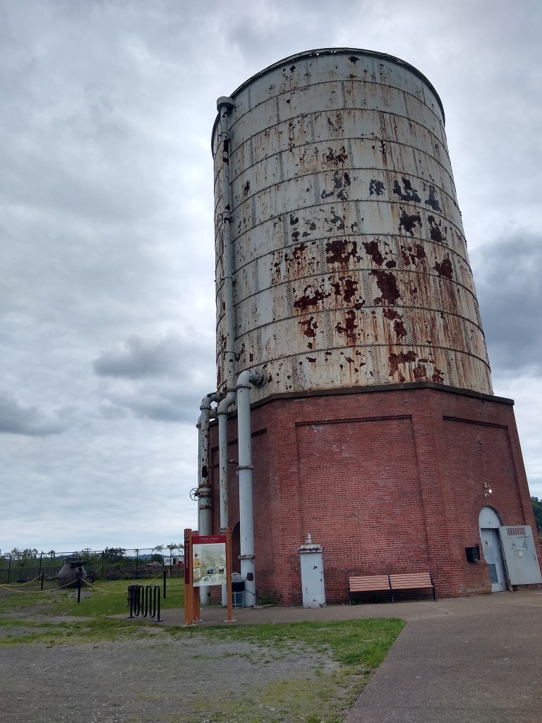
The Pumphouse and Homestead
I wasn’t intending on pausing at the Pumphouse for long but I’m glad I did. At mile 139, take at least a quick break and read some of the signage. This is the site of the Battle of Homestead – which isn’t like any other battleground I’ve stood on. Here’s my poorly worded synopsis of what happened here:
The steel mill pissed off the union workers who, from what I gather, had a bit too much “power” for the steel mill’s comfort. The mill brought in hired security (whatever that was called in 1892 – in this case they were called the “Pinkertons”). The hired security probably made it worse because union workers, now really pissed the hell off, came in with civil war weaponry (including a canon). It got out of hand, people died, and ultimately the government had to get involved to protect private property (and lives).
Bottom line, it’s a really interesting place with more than just the pumphouse to look at. There are a few sculptures, other memorials, an active train bridge, and a Labyrinth (that apparently, I completely missed).

In 2015 I had the unfortunate experience of having to bail off the trail in search of nourishment in Homestead. I remembered it being a little “rough” but this time, not so much. Homestead was actually quite a bit nicer than I remembered. My 2015 impression may have had to do with the nearly-physical-confrontation the McDonald’s manager and an employee who refused to be fired that day, were having. And let me just note; I think that employee kept their job, so persistence wins guys. Refuse to be fired.
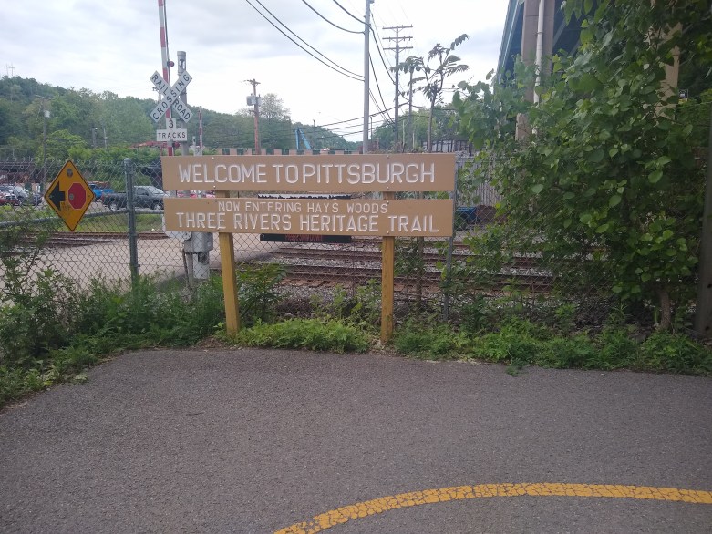
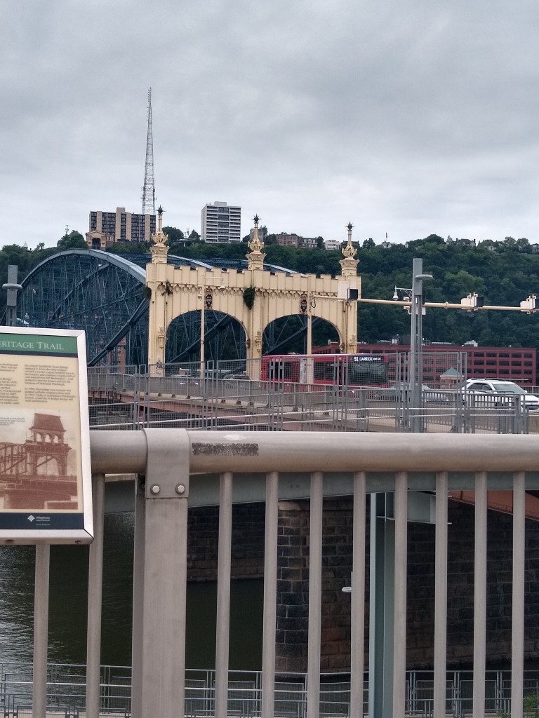
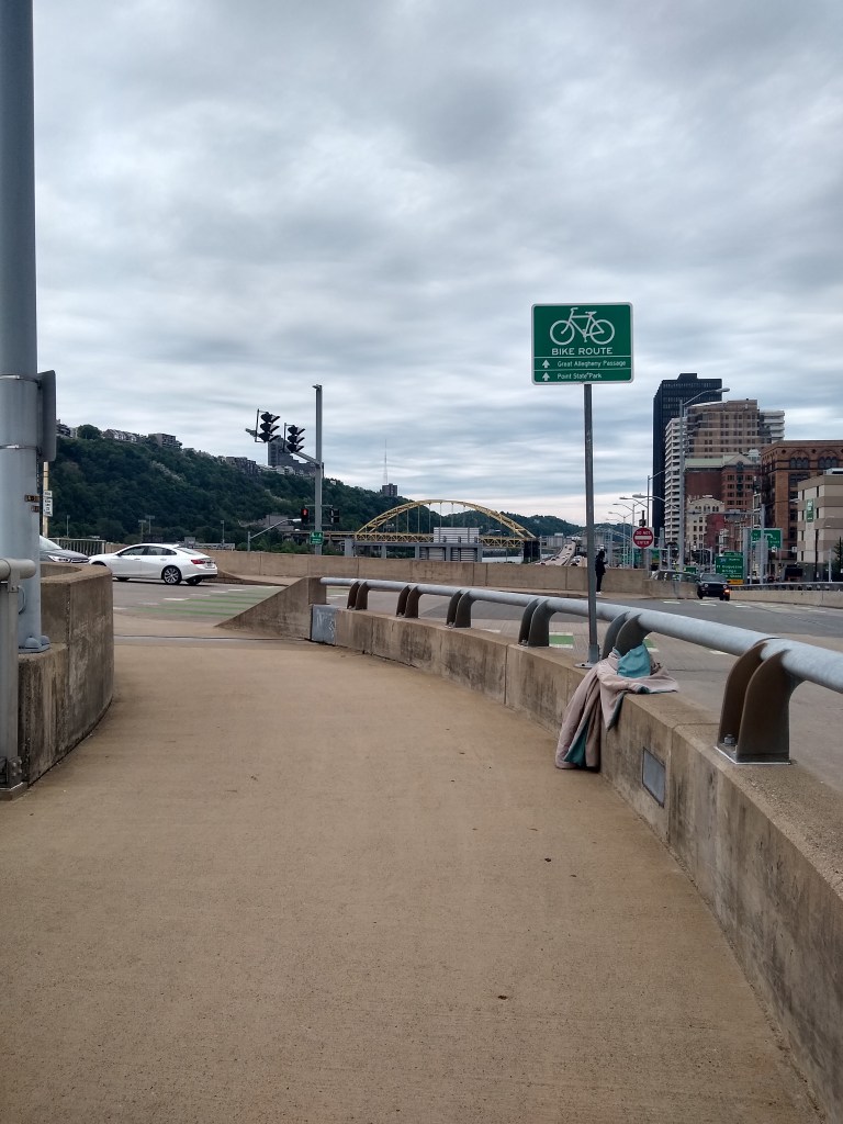
As you pass another amusement park, you’ll start to smell sulfur and other fumes that I probably shouldn’t find pleasing but honestly did. It’s rewarding to pass as many sights and smells as you have by this point on the trail and still be experiencing new things simply by pedaling there under your own power. The GAP kind of merges/shares the Three Rivers Heritage Trail at this point and I believe that technically continues until Point State Park (even if Three Rivers continues on).
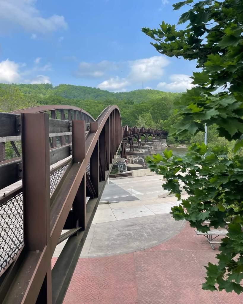
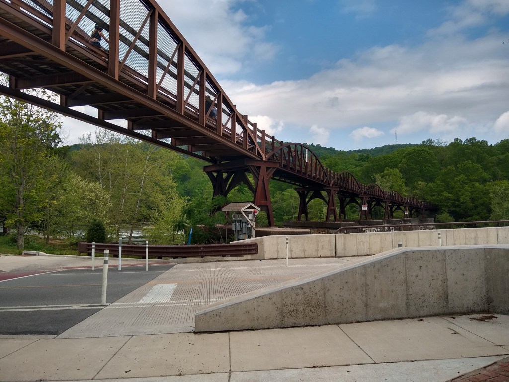
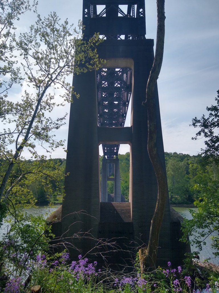
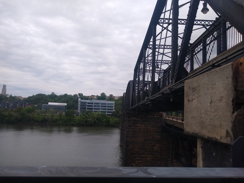
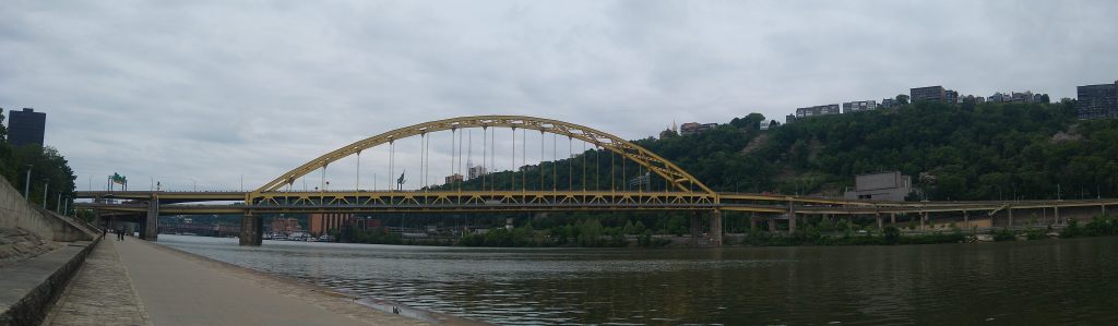
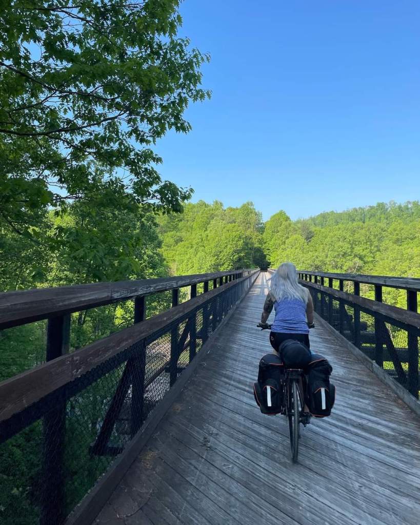
Before the last repurposed bridge, there’s some joker that painted on the trail “last hill” which made me giggle. They aren’t wrong though – the only climbs for there on out were really just the climb up the Hot Metal Bridge (Mile 146, and more of a switchback than a true hill). This bridge looks really badass at night in the pictures, but I haven’t been lucky enough thus far to see it in person at night. It is, regardless, a unique structure, and it signals “almost there” as you really feel you’re truly in Pittsburgh at this point.

Mile 150! Point State Park
Getting under/ past the Smithfield Bridge was unnecessarily confusing last time. Not because it’s hard to figure out how to get under it, but because I couldn’t figure out if I was supposed to cross at the bridge or go under. Truthfully, I’m still not entirely sure. But going under is a lot easier than the dumbassery I executed last time.
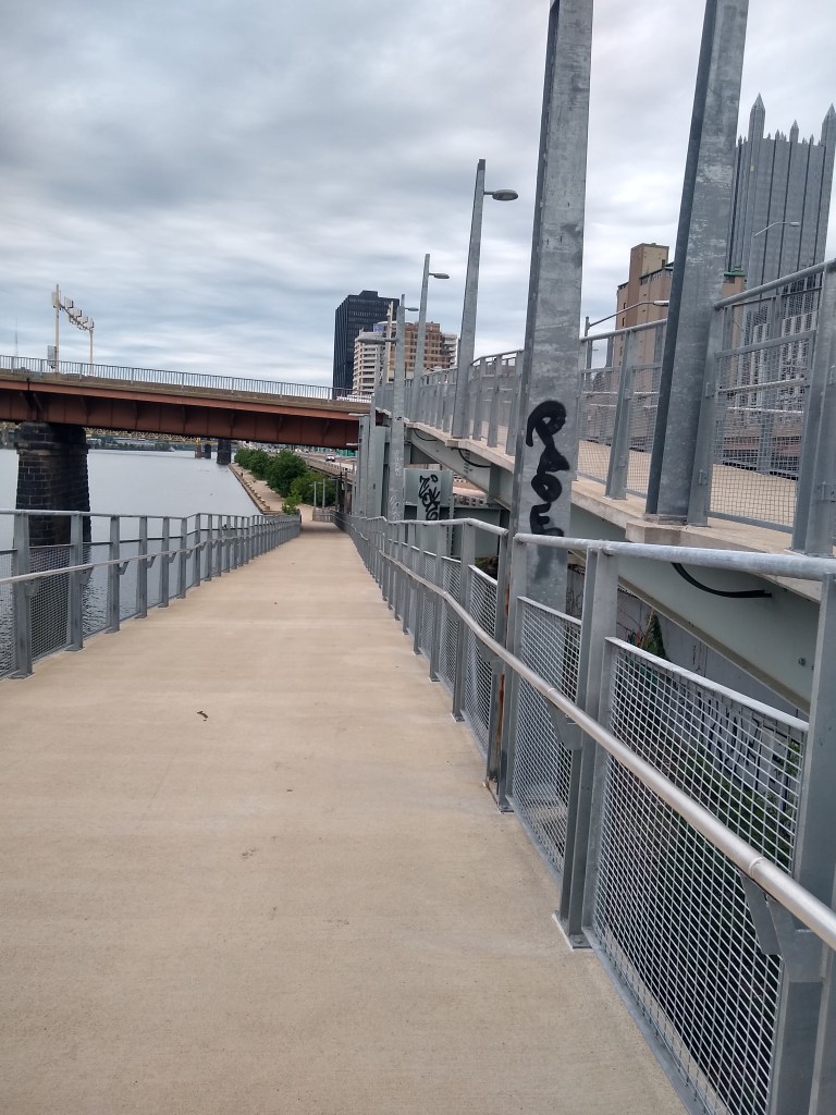

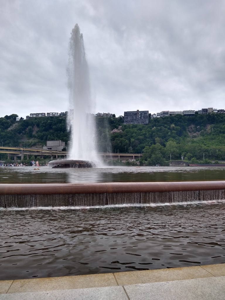
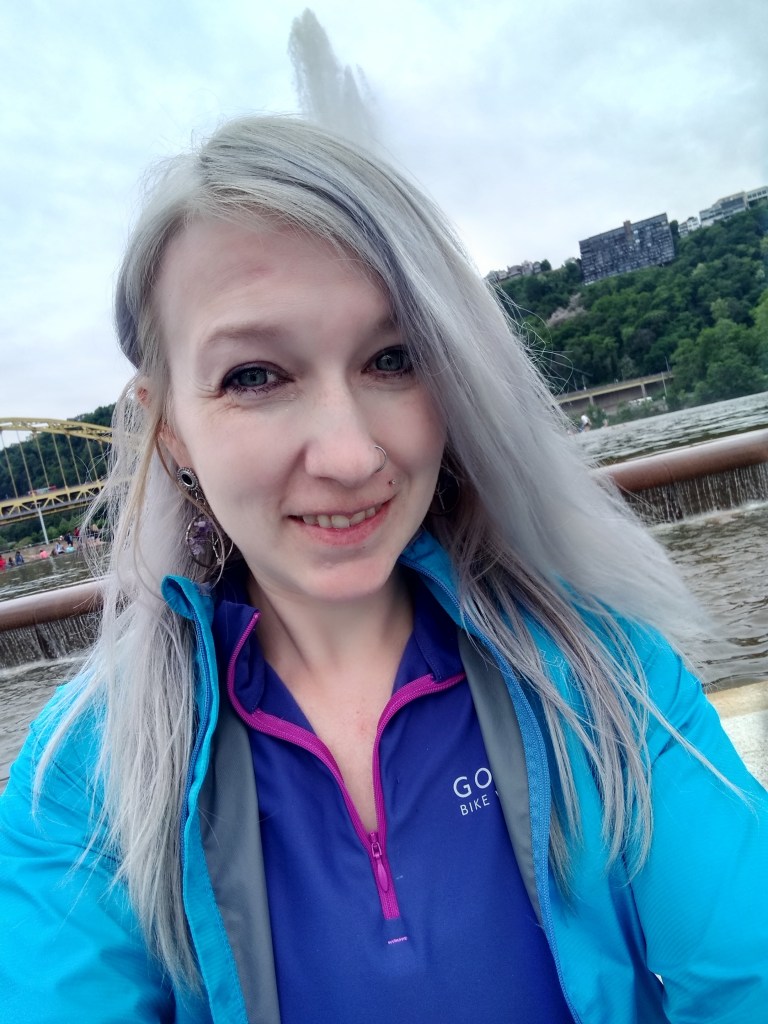
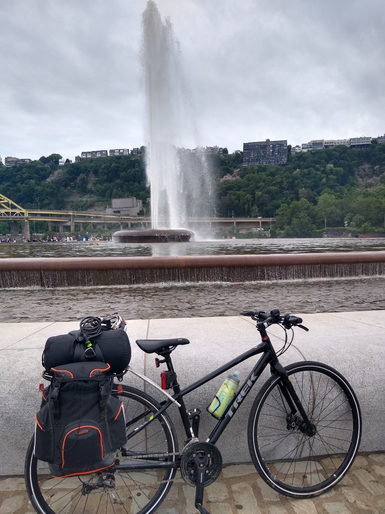
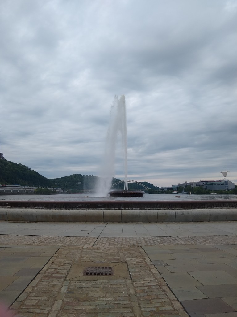
The park itself is refreshing and beautiful. You can see the gigantic fountain from a good distance away and as you get closer, especially on a hot day, it’s wonderful to sit on the edge and feel the mist. I wish I would have gotten here 30 minutes earlier so I could have grabbed a snack at the food court – but it was for good reason. I really took the time to absorb the rest of the trail and that’s all that mattered.
I chilled at here for about 30 minutes and then walked my bike to the DoubleTree. Which, side note, I have to say was both the most and least fancy place I stayed. Most-fancy in that they gave me cookies at check in, were very nicely dressed and super friendly. The fridge was very snazzy. But the rest of the room was meh. No microwave, USB chargers, ect. Fluffy pillows though, and a fantastic view. Definitely clean. And soap I wanted to huff like paint it smelled so good (fyi I don’t huff paint but last pregnancy I loved the smell of gas…. *shrug*).
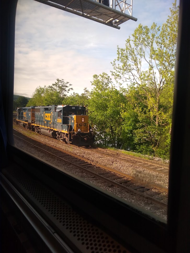
Amtrak Back
My phone kept me up all night, but to be fair I was a very light sleeper anyway that night. I absolutely couldn’t miss my train unless I wanted to call my husband to come get me (not exactly on my “must do’s” list). But the phone went off all night with “Hey you, train is gonna be late” texts. Which, ultimately, I welcomed. It gave me a comfortable amount of time to drag my ass slowly out of bed and to the train station at 5:20am instead of having to BE there at 5:20am.
The roads at night weren’t scary at all. The DoubleTree is about a half mile from the Amtrak station (so other than fluffy pillows and cookies- I highly recommend staying here for that reason), the streets were well lit and honestly, kind of pretty. The worst part was going to the exit clearly lit “AMTRAK” instead of the lower level also clearly labeled “Amtrak” but maybe not as obvious to me at 5AM. I had an unreasonable string of creative 5AM profanity come out of my (clearly) virgin lips over this that was honestly unnecessary. It is, nevertheless, how I cope with minor annoyances in my life that I blow out of proportion.
I waited an hour, and when the train got there, the conductor took me and one other (a sleeper car passenger) first so he could help me load my bike and get us going. It was pretty easy. Easier than I thought. I loaded my bike into the baggage area on the car (surprisingly no racks but enough baggage for “cushion” that I wasn’t worried about it – in retrospect I’d feel safer labeling my bike next time). I took my two panniers as my two carry on items and my helmet as 1 of 2 personal items allowed. (Btw no one checked or measured or cared. I’d guess they only do this if excessive baggage becomes an issue).
An additional note – at the time I rode the Amtrak there was a two-bike maximum. Less than a month later they expanded the capacity to 12. This RULES for me and other cyclists, but I can imagine the staff is probably annoyed at the extra loading time required from a general population that has little to no common sense especially at 5:20AM.
What I’m saying here is: please don’t fuck this up for everyone, ye of little common sense.

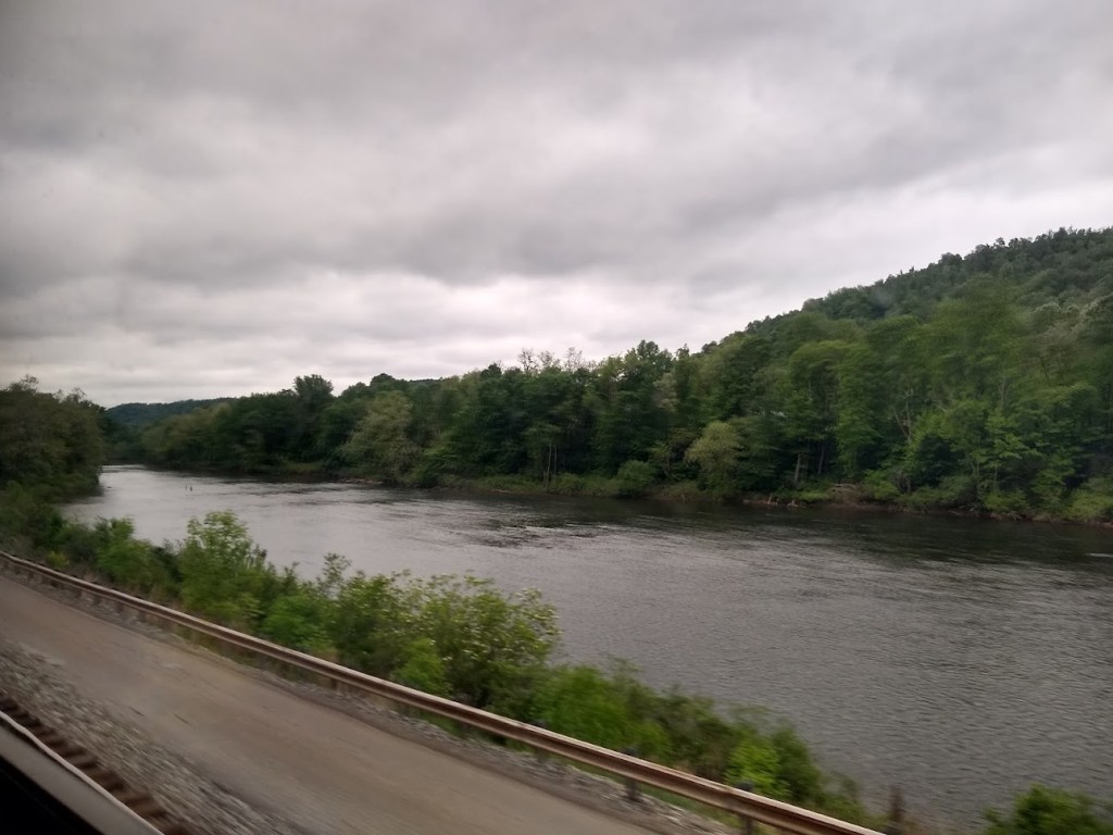
Other than Lieutenant Douchebag sitting behind me (always something to say, whining the entire time that the train was taking so long, and body odor that didn’t quit) the train ride was long, but an excellent way to get back. I got to retrace a lot of my steps as some of the rail rides beside the GAP. You get to re-see some of the small towns, you’ll stop (briefly) in Connellsville, roll by Ohiopyle (I was asleep for this…I was very sad) Rockwood, a few Viaducts, and take a longer stop in Cumberland.
Lots of tunnels, a food car that was far too amusing for me, and seats that were relatively easy to sleep in, outlets for charging, tray tables, reclining seats, ect – overall a great experience.
Eventually, and as Lieutenant Douchebag pointed out (a lot) it does take a while, you’ll be in DC. Getting off the train was unexpectedly easy, my bike was already unloaded and waiting for me. I met a super chill girl at the train station exit. She was so intrigued by my bags and sprang into “ARE YOU BIKEPACKING?!” I can only hope our conversation inspired her to do exactly what she wanted to do; which was apparently bikepack.
In Conclusion
For me, I’m clinically ill in the head, so I weaved my way through DC shenanigans until I was on the Mount Vernon trail. I took that to Alexandria and Jones Point, and then over and across Woodrow Wilson Bridge into National Harbor where I then met up with my husband, the baby, and a giant ice cream. (I also didn’t want to get stuck in rush hour traffic so biking, in this case, I believe was far quicker.)
Things I learned:
- I should have probably trained more. But that’s applicable to pretty much everything I do. This wasn’t bad on a less than satisfactory amount of training (I’m never happy with that amount – to be fair) and sometimes I like completely destroying myself in order to see what I’m lacking.
- Work calls don’t matter when you’d literally have to bike back. Lack of motorized transportation is freedom sometimes.
- Maybe I need a little more “fuck ’em” in my daily life. People are perfectly capable of helping themselves.
- Hotels can be great!
- I need more of an education on what fuel to put in my body. I always feel like I have this down – until I don’t.
- My sister is a wise soul about the 5 second rule.
- Sometimes, even if I want to go fast all the time, it pays to take a second, or a few hours, and enjoy my surroundings.
- I want to do this again….and again. And maybe again.

Leave a comment